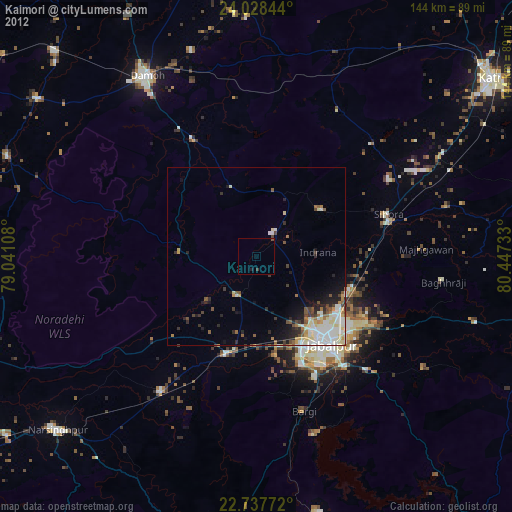
Kaimori night lights from space
Night Light of Kaimori (Madhya Pradesh) from space (India) Src. Average luminocity for 10x10km area is 6.3466% and for 50x50km: 15.8953%.
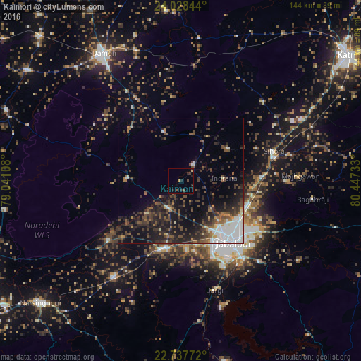
Analysis of Kaimori night lights 2016
Square area 10x10 km:
 0%
0%90-99
0%80-89
0.76%70-79
0.76%60-69
0%50-59
1.52%40-49
1.14%30-39
1.33%20-29
5.11%10-19
1.14%0-9
88.26%Square area 50x50 km:
3.03%90-99
1.88%80-89
0.67%70-79
0.82%60-69
1.71%50-59
2.82%40-49
3.35%30-39
4.21%20-29
6.69%10-19
9.73%0-9
65.08%Clear (daylight) street map image can be seen on geolist.org.
Map coordinates:
24° 1' 42.4" North, 79° 2' 27.9" East
23° 23' 4.7" North, 79° 44' 39.1" East
22° 44' 15.8" North, 80° 26' 50.4" East
Some cities around Kaimori sort by population:
• Jabalpur
32.1 km =19.9 mi,  139°
139°
• Panāgar
27.9 km =17.3 mi,  113°
113°
• Katangi
8.2 km =5.1 mi,  40°
40°
• Khamaria
22.5 km =14 mi, 141°
• Pātan
12.3 km =7.6 mi,  207°
207°
• Shāhpura
28.8 km =17.9 mi,  196°
196°
• Tendūkheda
20.9 km =13 mi,  273°
273°
• Majholi
22.5 km =14 mi,  54°
54°
1268615 (p: 20,154)
Sources (retrieved 2019-11-25):
» Earth at Night: Flat Maps 2012, 2016