Mairang night lights from space
Night Light of Mairang (Meghalaya) from space (India) Src. Average luminocity for 10x10km area is 1.6742% and for 50x50km: 3.1511%.
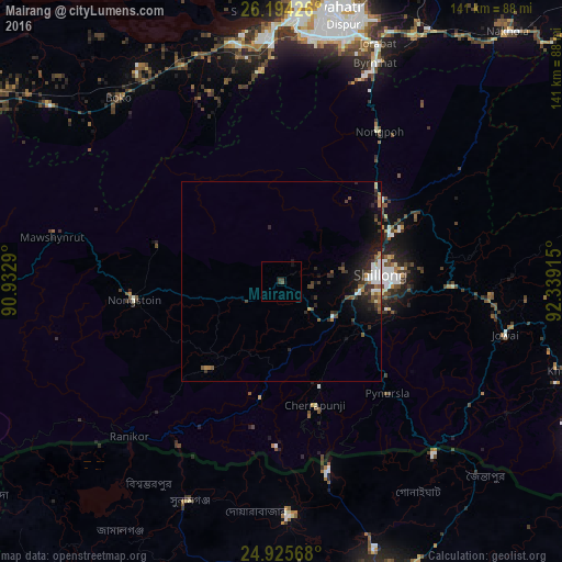
Analysis of Mairang night lights 2016
Square area 10x10 km:
 0%
0%90-99
0%80-89
0%70-79
0%60-69
0%50-59
0.19%40-49
0.76%30-39
2.08%20-29
0.38%10-19
0.76%0-9
95.83%Square area 50x50 km:
0.48%90-99
0.39%80-89
0.21%70-79
0.2%60-69
0.37%50-59
0.44%40-49
0.57%30-39
0.81%20-29
1.22%10-19
2.21%0-9
93.09%Clear (daylight) street map image can be seen on geolist.org.
Map coordinates:
26° 11' 39.3" North, 90° 55' 58.4" East
25° 33' 41.9" North, 91° 38' 9.7" East
24° 55' 32.4" North, 92° 20' 20.9" East
Some cities around Mairang sort by population:
• Guwahati
70.1 km =43.6 mi,  9°
9°
• Shillong
24.8 km =15.4 mi,  88°
88°
• Chhātak, BD
58.3 km =36.2 mi,  176°
176°
• Nongstoin
37.6 km =23.4 mi,  262°
262°
• Nongpoh
44.9 km =27.9 mi,  32°
32°
• Soalkuchi
67.7 km =42.1 mi,  354°
354°
• Cherrapunji
29.6 km =18.4 mi,  168°
168°
• Dispur
65.9 km =40.9 mi, 14°
1264285 (p: 12,586)
Sources (retrieved 2019-11-25):
» Earth at Night: Flat Maps 2012, 2016