Maheshwar night lights from space
Night Light of Maheshwar (Madhya Pradesh) from space (India) Src. Average luminocity for 10x10km area is 16.6865% and for 50x50km: 9.2728%.
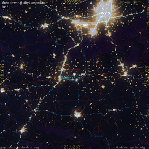
Analysis of Maheshwar night lights 2016
Square area 10x10 km:
 1.19%
1.19%90-99
1.98%80-89
0.6%70-79
0.99%60-69
2.78%50-59
1.59%40-49
0.99%30-39
5.36%20-29
2.38%10-19
22.02%0-9
60.12%Square area 50x50 km:
0.19%90-99
0.93%80-89
0.78%70-79
1.04%60-69
1.55%50-59
1.91%40-49
1.68%30-39
1.98%20-29
2.28%10-19
8.37%0-9
79.3%Clear (daylight) street map image can be seen on geolist.org.
Map coordinates:
22° 49' 31.8" North, 74° 53' 2.5" East
22° 10' 33.3" North, 75° 35' 13.7" East
21° 31' 23.9" North, 76° 17' 25" East
Some cities around Maheshwar sort by population:
• Khargone
39.3 km =24.4 mi,  175°
175°
• Pithampur
48.7 km =30.3 mi,  13°
13°
• Sanāwad
49.7 km =30.9 mi,  90°
90°
• Dhāmnod
12.6 km =7.8 mi,  287°
287°
• Kasrāwad
5.9 km =3.7 mi,  155°
155°
• Dharampuri
25.2 km =15.7 mi,  263°
263°
• Māndleshwar
7.5 km =4.7 mi, 89°
• Mānpur
28.6 km =17.8 mi, 6°
1264385 (p: 21,500)
Sources (retrieved 2019-11-25):
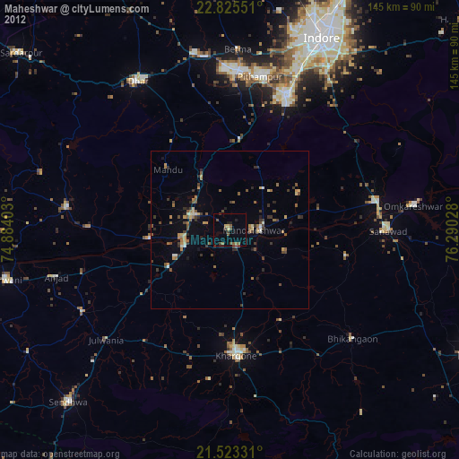
» Earth at Night: Flat Maps 2012, 2016