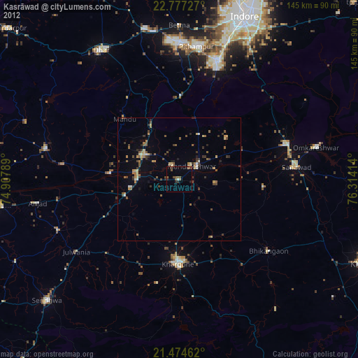
Kasrāwad night lights from space
Night Light of Kasrāwad (Madhya Pradesh) from space (India) Src. Average luminocity for 10x10km area is 15.3968% and for 50x50km: 8.9905%.
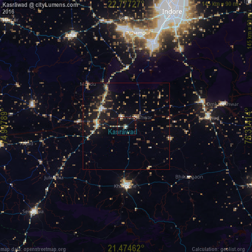
Analysis of Kasrāwad night lights 2016
Square area 10x10 km:
 0.6%
0.6%90-99
3.37%80-89
0.79%70-79
0.79%60-69
0.79%50-59
3.97%40-49
0.99%30-39
3.37%20-29
4.37%10-19
15.28%0-9
65.67%Square area 50x50 km:
0.2%90-99
0.99%80-89
0.78%70-79
1.05%60-69
1.46%50-59
1.95%40-49
1.57%30-39
1.8%20-29
2.03%10-19
8.22%0-9
79.95%Clear (daylight) street map image can be seen on geolist.org.
Map coordinates:
22° 46' 38.2" North, 74° 54' 28.4" East
22° 7' 38.8" North, 75° 36' 39.6" East
21° 28' 28.6" North, 76° 18' 50.9" East
Some cities around Kasrāwad sort by population:
• Khargone
33.9 km =21.1 mi,  179°
179°
• Sanāwad
47.5 km =29.5 mi,  83°
83°
• Dhāmnod
17.1 km =10.6 mi,  302°
302°
• Maheshwar
5.9 km =3.7 mi,  335°
335°
• Bhikangaon
46.5 km =28.9 mi,  128°
128°
• Dharampuri
27.6 km =17.1 mi,  275°
275°
• Māndleshwar
7.4 km =4.6 mi,  43°
43°
• Mānpur
33.8 km =21 mi,  1°
1°
1267558 (p: 21,484)
Sources (retrieved 2019-11-25):
» Earth at Night: Flat Maps 2012, 2016