Losal night lights from space
Night Light of Losal (Rajasthan) from space (India) Src. Average luminocity for 10x10km area is 16.2557% and for 50x50km: 6.1469%.
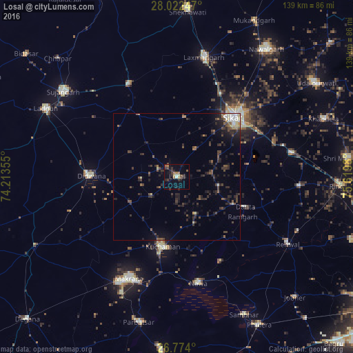
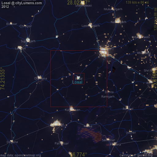
Analysis of Losal night lights 2016
Square area 10x10 km:
 0.76%
0.76%90-99
0.76%80-89
0.95%70-79
1.89%60-69
3.6%50-59
2.27%40-49
3.41%30-39
4.36%20-29
5.11%10-19
8.33%0-9
68.56%Square area 50x50 km:
0.36%90-99
0.58%80-89
0.43%70-79
0.27%60-69
0.68%50-59
1.09%40-49
1.54%30-39
1.91%20-29
2.79%10-19
3.61%0-9
86.73%Clear (daylight) street map image can be seen on geolist.org.
Map coordinates:
28° 1' 20.9" North, 74° 12' 48.8" East
27° 24' 0" North, 74° 55' 0" East
26° 46' 26.4" North, 75° 37' 11.3" East
Some cities around Losal sort by population:
• Sīkar
32.3 km =20.1 mi,  43°
43°
• Makrāna
43.9 km =27.3 mi,  205°
205°
• Kuchāman
28.7 km =17.8 mi,  191°
191°
• Dīdwāna
33.7 km =20.9 mi,  270°
270°
• Rāmgarh
30.8 km =19.1 mi,  122°
122°
• Nāwa
43.1 km =26.8 mi,  168°
168°
• Meethari Marwar
30 km =18.6 mi,  310°
310°
• Bhuma
42.7 km =26.5 mi,  2°
2°
1264756 (p: 27,964)
Sources (retrieved 2019-11-25):
» Earth at Night: Flat Maps 2012, 2016