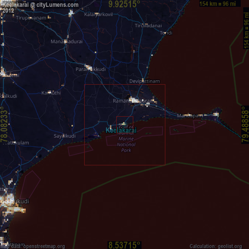
Keelakarai night lights from space
Night Light of Keelakarai (Tamil Nadu) from space (India) Src. Average luminocity for 10x10km area is 3.8571% and for 50x50km: 2.1901%.
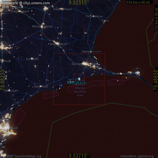
Analysis of Keelakarai night lights 2016
Square area 10x10 km:
 1.3%
1.3%90-99
1.3%80-89
0%70-79
0%60-69
0%50-59
0.87%40-49
0%30-39
0%20-29
0.65%10-19
0.22%0-9
95.67%Square area 50x50 km:
0.16%90-99
0.22%80-89
0.25%70-79
0.34%60-69
0.24%50-59
0.27%40-49
0.41%30-39
0.46%20-29
0.51%10-19
1.16%0-9
95.99%Clear (daylight) street map image can be seen on geolist.org.
Map coordinates:
9° 55' 30.5" North, 78° 4' 56.4" East
9° 13' 54.6" North, 78° 47' 7.6" East
8° 32' 13.7" North, 79° 29' 18.9" East
Some cities around Keelakarai sort by population:
• Paramagudi
41 km =25.5 mi,  328°
328°
• Ramanathapuram
16.3 km =10.1 mi,  17°
17°
• Mandapam
37.4 km =23.2 mi,  82°
82°
• Mudukulattūr
32.2 km =20 mi,  292°
292°
• Sāyalkudi
37.8 km =23.5 mi,  259°
259°
• Periyapattinam
13.6 km =8.5 mi,  70°
70°
• Tiruppālaikudi
37.8 km =23.5 mi, 22°
• Abirāmam
44.6 km =27.7 mi,  301°
301°
1252646 (p: 30,468)
Sources (retrieved 2019-11-25):
» Earth at Night: Flat Maps 2012, 2016