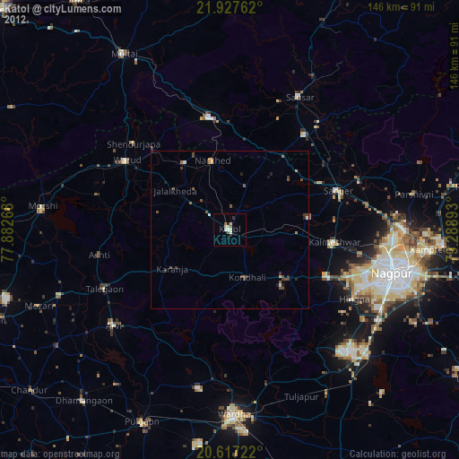
Kātol night lights from space
Night Light of Kātol (Maharashtra) from space (India) Src. Average luminocity for 10x10km area is 10.3333% and for 50x50km: 3.4214%.
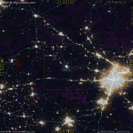
Analysis of Kātol night lights 2016
Square area 10x10 km:
 1.89%
1.89%90-99
1.89%80-89
0%70-79
0.38%60-69
0.38%50-59
3.98%40-49
1.33%30-39
0.57%20-29
3.03%10-19
0.19%0-9
86.36%Square area 50x50 km:
0.28%90-99
0.37%80-89
0.18%70-79
0.21%60-69
0.43%50-59
0.65%40-49
0.99%30-39
0.81%20-29
1.04%10-19
0.99%0-9
94.05%Clear (daylight) street map image can be seen on geolist.org.
Map coordinates:
21° 55' 39.4" North, 77° 52' 57.6" East
21° 16' 26" North, 78° 35' 8.9" East
20° 37' 2" North, 79° 17' 20.1" East
Some cities around Kātol sort by population:
• Warud
39.4 km =24.5 mi,  303°
303°
• Pāndhurnā
36.3 km =22.6 mi,  350°
350°
• Saoner
36.9 km =22.9 mi,  70°
70°
• Kalmeshwar
34.9 km =21.7 mi,  97°
97°
• Khāpa
44.2 km =27.5 mi, 68°
• Mohgaon
43.5 km =27 mi,  20°
20°
• Mowād
25.4 km =15.8 mi,  326°
326°
• Mohpa
25.6 km =15.9 mi,  80°
80°
1267461 (p: 41,893)
Sources (retrieved 2019-11-25):
» Earth at Night: Flat Maps 2012, 2016