Kālundri night lights from space
Night Light of Kālundri (Maharashtra) from space (India) Src. Average luminocity for 10x10km area is 80.4286% and for 50x50km: 52.4772%.
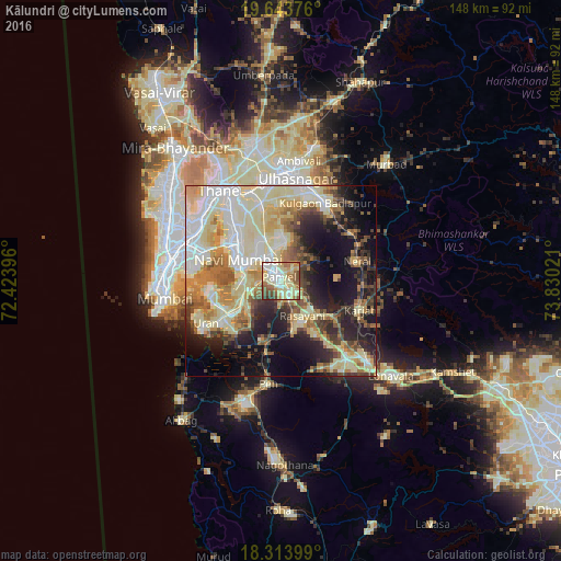
Analysis of Kālundri night lights 2016
Square area 10x10 km:
 12.12%
90-99
24.68%80-89
26.62%70-79
8.66%60-69
10.39%50-59
9.52%40-49
5.41%30-39
2.6%20-29
0%10-19
0%0-9
0%Square area 50x50 km:
7.72%90-99
14.47%80-89
12.4%70-79
6.26%60-69
6.73%50-59
5.21%40-49
5.16%30-39
4.9%20-29
7.85%10-19
13.56%0-9
15.72%Clear (daylight) street map image can be seen on geolist.org.
Map coordinates:
19° 38' 37.5" North, 72° 25' 26.3" East
18° 58' 48.7" North, 73° 7' 37.5" East
18° 18' 50.4" North, 73° 49' 48.8" East
Some cities around Kālundri sort by population:
• Navi Mumbai
13.3 km =8.3 mi,  298°
298°
• Panvel
2 km =1.2 mi, 298°
• Airoli
23.4 km =14.5 mi,  324°
324°
• Karjat
22.1 km =13.7 mi,  110°
110°
• Uran
22.8 km =14.2 mi,  240°
240°
• Neral
20.6 km =12.8 mi,  76°
76°
• Artist Village
10.6 km =6.6 mi, 303°
• Mātherān
14.5 km =9 mi,  88°
88°
1268308 (p: 8,101)
Sources (retrieved 2019-11-25):
» Earth at Night: Flat Maps 2012, 2016