Jhālu night lights from space
Night Light of Jhālu (Uttar Pradesh) from space (India) Src. Average luminocity for 10x10km area is 27.125% and for 50x50km: 20.3722%.
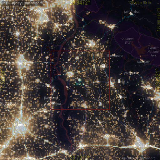
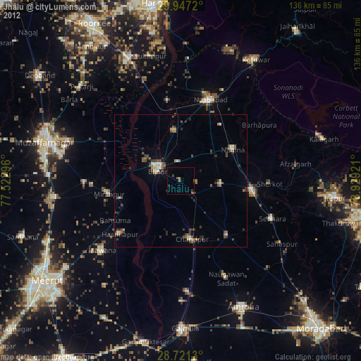
Analysis of Jhālu night lights 2016
Square area 10x10 km:
 0.38%
0.38%90-99
1.89%80-89
0.95%70-79
2.08%60-69
5.68%50-59
3.79%40-49
7.01%30-39
7.58%20-29
16.86%10-19
46.02%0-9
7.77%Square area 50x50 km:
0.47%90-99
1.42%80-89
1.37%70-79
1.71%60-69
2.81%50-59
3.38%40-49
5.89%30-39
6.41%20-29
8.91%10-19
29.47%0-9
38.16%Clear (daylight) street map image can be seen on geolist.org.
Map coordinates:
29° 56' 49.9" North, 77° 31' 22.7" East
29° 20' 9.9" North, 78° 13' 33.9" East
28° 43' 16.7" North, 78° 55' 45.2" East
Some cities around Jhālu sort by population:
• Bijnor
9.6 km =6 mi,  295°
295°
• Nagīna
23.7 km =14.7 mi,  59°
59°
• Chāndpur
22.8 km =14.2 mi,  168°
168°
• Kīratpur
19.1 km =11.9 mi,  354°
354°
• Nihtaur
15.7 km =9.8 mi,  94°
94°
• Nūrpur
27.3 km =17 mi,  139°
139°
• Mandāwar
19.3 km =12 mi,  330°
330°
• Haldaur
7.6 km =4.7 mi,  132°
132°
1269019 (p: 20,356)
Sources (retrieved 2019-11-25):
» Earth at Night: Flat Maps 2012, 2016