Jewar night lights from space
Night Light of Jewar (Uttar Pradesh) from space (India) Src. Average luminocity for 10x10km area is 42.4943% and for 50x50km: 29.0531%.
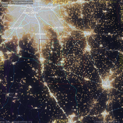
Analysis of Jewar night lights 2016
Square area 10x10 km:
 2.08%
2.08%90-99
3.22%80-89
6.44%70-79
8.9%60-69
6.25%50-59
9.47%40-49
9.85%30-39
11.74%20-29
21.97%10-19
19.7%0-9
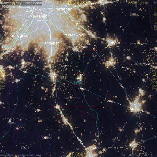
0.38%Square area 50x50 km:
1.35%90-99
2.94%80-89
3.61%70-79
3%60-69
4.18%50-59
5.22%40-49
7.29%30-39
8.13%20-29
11.58%10-19
28.68%0-9
24.01%Clear (daylight) street map image can be seen on geolist.org.
Map coordinates:
28° 44' 25.2" North, 76° 51' 15.2" East
28° 7' 19.2" North, 77° 33' 26.4" East
27° 30' 0.4" North, 78° 15' 37.7" East
Some cities around Jewar sort by population:
• Palwal
22.9 km =14.2 mi,  276°
276°
• Hodal
31.7 km =19.7 mi,  216°
216°
• Rabūpura
15.1 km =9.4 mi,  17°
17°
• Dankaur
25.5 km =15.8 mi,  359°
359°
• Jahāngīrpur
15.8 km =9.8 mi,  66°
66°
• Hasanpur
18 km =11.2 mi,  199°
199°
• Bīlāspur
30.6 km =19 mi,  12°
12°
• Bājna
27.6 km =17.1 mi,  154°
154°
1269056 (p: 29,316)
Sources (retrieved 2019-11-25):
» Earth at Night: Flat Maps 2012, 2016