Indore night lights from space
Night Light of Indore (Madhya Pradesh) from space (India) Src. Average luminocity for 10x10km area is 98.131% and for 50x50km: 42.0521%.
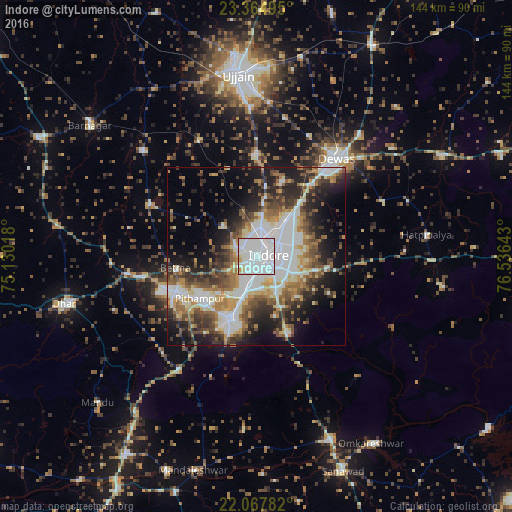
Analysis of Indore night lights 2016
Square area 10x10 km:
 65.28%
90-99
28.57%80-89
3.57%70-79
1.98%60-69
0.6%50-59
0%40-49
0%30-39
0%20-29
0%10-19
0%0-9
0%Square area 50x50 km:
8.66%90-99
10.42%80-89
3.89%70-79
4.32%60-69
5.49%50-59
5.91%40-49
6.47%30-39
6.87%20-29
8.8%10-19
12.6%0-9
26.57%Clear (daylight) street map image can be seen on geolist.org.
Map coordinates:
23° 21' 53.8" North, 75° 7' 48.6" East
22° 43' 4.5" North, 75° 49' 59.9" East
22° 4' 4.2" North, 76° 32' 11.1" East
Some cities around Indore sort by population:
• Dewas
35.7 km =22.2 mi,  39°
39°
• Pithampur
19.1 km =11.9 mi,  227°
227°
• Depālpur
33.3 km =20.7 mi,  296°
296°
• Gautampura
43.9 km =27.3 mi,  312°
312°
• Sānwer
28.5 km =17.7 mi,  358°
358°
• Betma
22.7 km =14.1 mi,  261°
261°
• Hātod
12.8 km =8 mi, 311°
• Mānpur
38.6 km =24 mi,  214°
214°
1269743 (p: 1,837,041)
Sources (retrieved 2019-11-25):
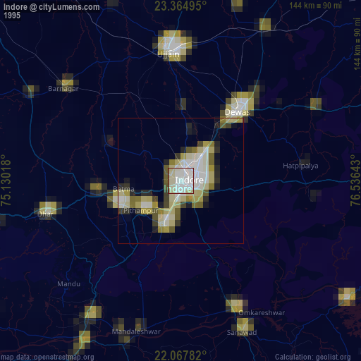
» NASA, Earths city lights 1995
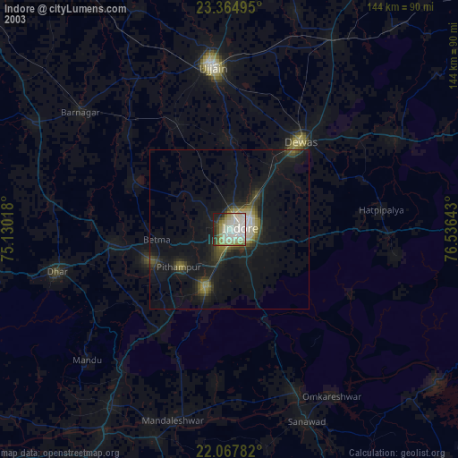
» NASA city lights 2003
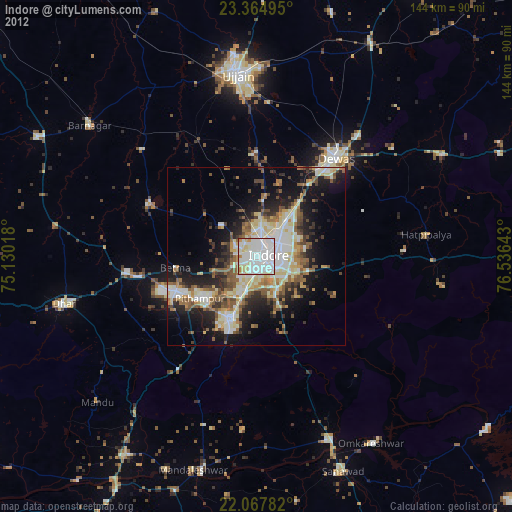
» Earth at Night: Flat Maps 2012, 2016