Idukki night lights from space
Night Light of Idukki (Kerala) from space (India) Src. Average luminocity for 10x10km area is 0.5801% and for 50x50km: 0.1105%.
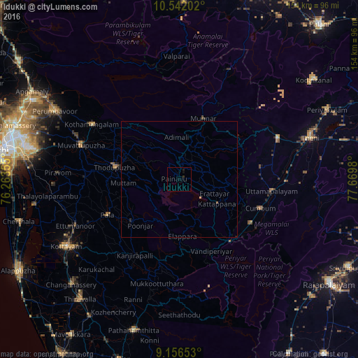
Analysis of Idukki night lights 2016
Square area 10x10 km:
 0%
0%90-99
0%80-89
0%70-79
0%60-69
0%50-59
0%40-49
0%30-39
0.87%20-29
0.87%10-19
0.87%0-9
97.4%Square area 50x50 km:
0%90-99
0%80-89
0.03%70-79
0%60-69
0.03%50-59
0%40-49
0%30-39
0.03%20-29
0.13%10-19
0.07%0-9
99.7%Clear (daylight) street map image can be seen on geolist.org.
Map coordinates:
10° 32' 31.3" North, 76° 15' 48.8" East
9° 51' 0" North, 76° 58' 0" East
9° 9' 23.5" North, 77° 40' 11.3" East
Some cities around Idukki sort by population:
• Munnar
28.5 km =17.7 mi,  21°
21°
• Cumbum
37.1 km =23.1 mi,  109°
109°
• Gudalur
36.4 km =22.6 mi,  121°
121°
• Erāttupetta
27.4 km =17 mi,  228°
228°
• Kuttampuzha
41.9 km =26 mi,  322°
322°
• Uttamapālaiyam
39.8 km =24.7 mi,  96°
96°
• Kombai
36.1 km =22.4 mi,  90°
90°
• Lālam
32.8 km =20.4 mi,  243°
243°
1269811 (p: 11,248)
Sources (retrieved 2019-11-25):
» Earth at Night: Flat Maps 2012, 2016