Hasanpur night lights from space
Night Light of Hasanpur (Uttar Pradesh) from space (India) Src. Average luminocity for 10x10km area is 28.0057% and for 50x50km: 28.0844%.
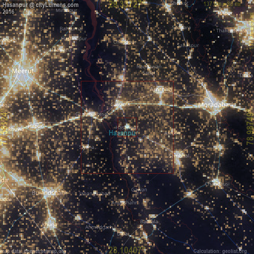


Analysis of Hasanpur night lights 2016
Square area 10x10 km:
 0.57%
0.57%90-99
3.98%80-89
1.52%70-79
1.52%60-69
1.7%50-59
5.11%40-49
8.33%30-39
10.8%20-29
9.85%10-19
51.14%0-9
5.49%Square area 50x50 km:
0.65%90-99
1.95%80-89
2.07%70-79
2.1%60-69
4.1%50-59
7.04%40-49
10.15%30-39
10.77%20-29
15.67%10-19
20.53%0-9
24.99%Clear (daylight) street map image can be seen on geolist.org.
Map coordinates:
29° 20' 14.2" North, 77° 34' 52.5" East
28° 43' 21" North, 78° 17' 3.7" East
28° 6' 14.7" North, 78° 59' 15" East
Some cities around Hasanpur sort by population:
• Sambhal
31.8 km =19.8 mi,  118°
118°
• Amroha
27 km =16.8 mi,  41°
41°
• Gajraula
14.4 km =8.9 mi,  342°
342°
• Garhmuktesar
19.2 km =11.9 mi,  292°
292°
• Bachhraon
23.2 km =14.4 mi,  347°
347°
• Dhanaura
26.5 km =16.5 mi, 354°
• Khānpur
29.9 km =18.6 mi,  225°
225°
• Gawān
34.3 km =21.3 mi,  168°
168°
1270251 (p: 57,481)
Sources (retrieved 2019-11-25):
» NASA, Earths city lights 1995
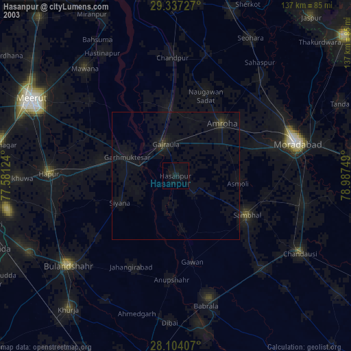
» NASA city lights 2003
» Earth at Night: Flat Maps 2012, 2016