Ashoknagar Kalyangarh night lights from space
Night Light of Ashoknagar Kalyangarh (West Bengal) from space (India) Src. Average luminocity for 10x10km area is 56.4563% and for 50x50km: 44.688%.
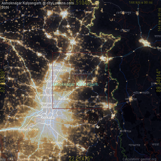
Analysis of Ashoknagar Kalyangarh night lights 2016
Square area 10x10 km:
 1.98%
1.98%90-99
18.85%80-89
11.31%70-79
3.37%60-69
6.15%50-59
10.12%40-49
14.88%30-39
10.52%20-29
13.89%10-19
8.93%0-9
0%Square area 50x50 km:
5.09%90-99
12.72%80-89
5.45%70-79
4.21%60-69
5.73%50-59
7.72%40-49
8.56%30-39
8.24%20-29
9.67%10-19
14.57%0-9
18.03%Clear (daylight) street map image can be seen on geolist.org.
Map coordinates:
23° 30' 37.7" North, 87° 56' 2" East
22° 51' 51" North, 88° 38' 13.2" East
22° 12' 53.1" North, 89° 20' 24.5" East
Some cities around Ashoknagar Kalyangarh sort by population:
• Hābra
3.1 km =1.9 mi,  141°
141°
• Gobārdānga
12.2 km =7.6 mi,  83°
83°
• Nagarukhra
8.5 km =5.3 mi,  0°
0°
• Gurdaha
19.1 km =11.9 mi, 138°
• Haringhāta
12.9 km =8 mi,  330°
330°
• Rāmchandrapur
17 km =10.6 mi,  282°
282°
• Ula
17.8 km =11.1 mi,  207°
207°
• Sankarpur
19.1 km =11.9 mi,  264°
264°
7302861 (p: 111,475)
Sources (retrieved 2019-11-25):
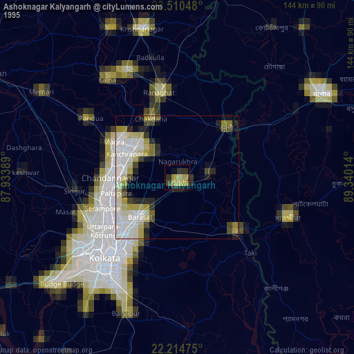
» NASA, Earths city lights 1995
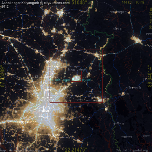
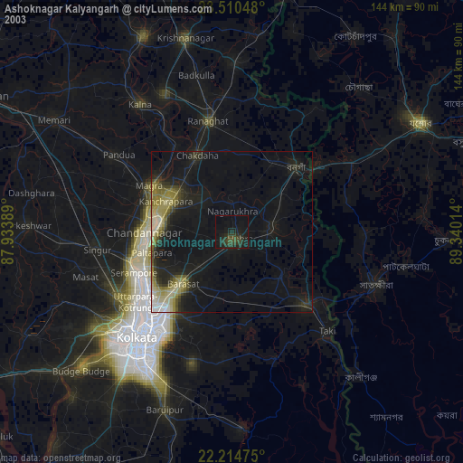
» NASA city lights 2003
» Earth at Night: Flat Maps 2012, 2016