Ganj Murādābād night lights from space
Night Light of Ganj Murādābād (Uttar Pradesh) from space (India) Src. Average luminocity for 10x10km area is 2.2004% and for 50x50km: 3.0185%.
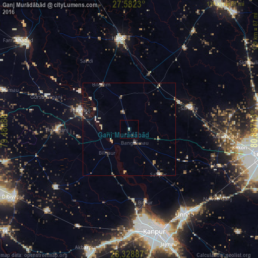
Analysis of Ganj Murādābād night lights 2016
Square area 10x10 km:
 0%
0%90-99
0.79%80-89
0%70-79
0%60-69
0%50-59
0.79%40-49
0.79%30-39
0%20-29
0.79%10-19
0%0-9
96.83%Square area 50x50 km:
0.17%90-99
0.63%80-89
0.34%70-79
0.25%60-69
0.25%50-59
0.34%40-49
0.57%30-39
0.46%20-29
0.79%10-19
1.68%0-9
94.52%Clear (daylight) street map image can be seen on geolist.org.
Map coordinates:
27° 34' 56.3" North, 79° 28' 51.2" East
26° 57' 26.4" North, 80° 11' 2.4" East
26° 19' 43.9" North, 80° 53' 13.7" East
Some cities around Ganj Murādābād sort by population:
• Kannauj
28.4 km =17.6 mi,  292°
292°
• Bāngarmau
7.8 km =4.8 mi,  159°
159°
• Bilgrām
28.5 km =17.7 mi,  328°
328°
• Safīpur
29.1 km =18.1 mi,  147°
147°
• Bilhaur
17.4 km =10.8 mi,  223°
223°
• Mādhoganj
18.4 km =11.4 mi,  346°
346°
• Ugu
22.4 km =13.9 mi,  142°
142°
• Fatehpur Chaurāsi
20.4 km =12.7 mi, 156°
1271616 (p: 9,970)
Sources (retrieved 2019-11-25):
» Earth at Night: Flat Maps 2012, 2016