Dādri night lights from space
Night Light of Dādri (Uttar Pradesh) from space (India) Src. Average luminocity for 10x10km area is 85.7197% and for 50x50km: 70.9592%.
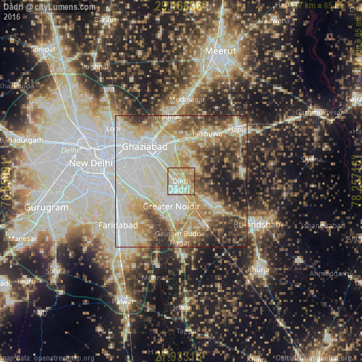
Analysis of Dādri night lights 2016
Square area 10x10 km:
 14.96%
90-99
26.33%80-89
34.28%70-79
11.93%60-69
10.98%50-59
1.33%40-49
0.19%30-39
0%20-29
0%10-19
0%0-9
0%Square area 50x50 km:
18.54%90-99
17.54%80-89
13.86%70-79
7.51%60-69
9.22%50-59
7.85%40-49
7.73%30-39
6.77%20-29
6.56%10-19
4.4%0-9
0.02%Clear (daylight) street map image can be seen on geolist.org.
Map coordinates:
29° 10' 6.1" North, 76° 51' 3.3" East
28° 33' 9.3" North, 77° 33' 14.5" East
27° 55' 59.4" North, 78° 15' 25.8" East
Some cities around Dādri sort by population:
• Ghāziābād
16.8 km =10.4 mi,  318°
318°
• Noida
22.1 km =13.7 mi,  277°
277°
• Greater Noida
6.5 km =4 mi,  195°
195°
• Pilkhua
20.4 km =12.7 mi,  29°
29°
• Sikandarābād
18.1 km =11.2 mi,  128°
128°
• Dāsna
14.2 km =8.8 mi,  347°
347°
• Dankaur
22.4 km =13.9 mi,  179°
179°
• Bīlāspur
19.2 km =11.9 mi,  159°
159°
1273724 (p: 70,609)
Sources (retrieved 2019-11-25):
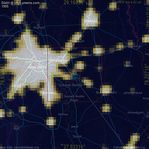
» NASA, Earths city lights 1995
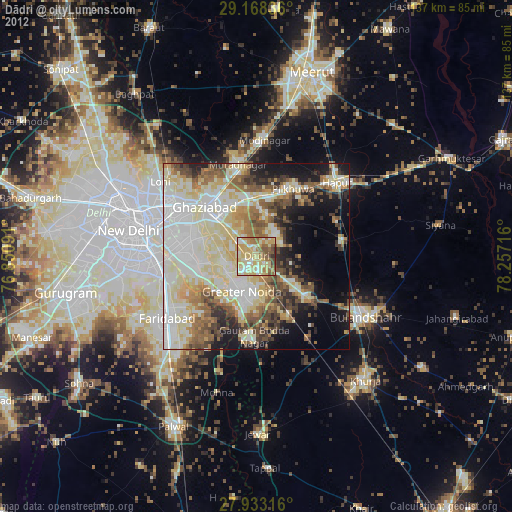
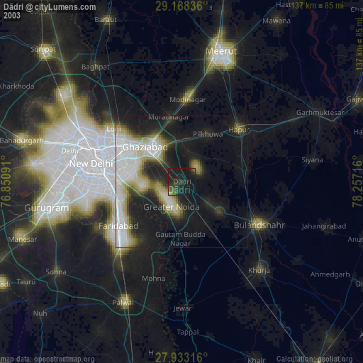
» NASA city lights 2003
» Earth at Night: Flat Maps 2012, 2016