Cochin night lights from space
Night Light of Cochin (Kerala) from space (India) Src. Average luminocity for 10x10km area is 72.9669% and for 50x50km: 19.6109%.
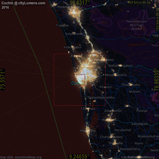
Analysis of Cochin night lights 2016
Square area 10x10 km:
 25.21%
90-99
24.38%80-89
5.37%70-79
10.33%60-69
6.4%50-59
2.48%40-49
1.45%30-39
3.51%20-29
13.43%10-19
6.82%0-9
0.62%Square area 50x50 km:
2.38%90-99
3.68%80-89
2.79%70-79
3.88%60-69
2.9%50-59
2.9%40-49
3.59%30-39
3.35%20-29
3.64%10-19
6.46%0-9
64.43%Clear (daylight) street map image can be seen on geolist.org.
Map coordinates:
10° 37' 54.1" North, 75° 33' 25.6" East
9° 56' 23.6" North, 76° 15' 36.8" East
9° 14' 47.7" North, 76° 57' 48.1" East
Some cities around Cochin sort by population:
• Kalamassery
15.3 km =9.5 mi,  28°
28°
• Aroor
9.2 km =5.7 mi,  147°
147°
• Elūr
14.3 km =8.9 mi,  10°
10°
• Kumbalam
6.7 km =4.2 mi,  123°
123°
• Aluva
21.2 km =13.2 mi, 28°
• Alwaye
21.2 km =13.2 mi, 29°
• Kutiatodu
17.5 km =10.9 mi, 152°
• Arukutti
12.8 km =8 mi,  129°
129°
1273874 (p: 604,696)
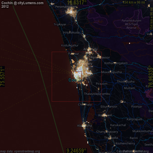
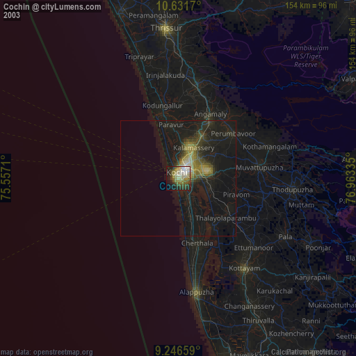
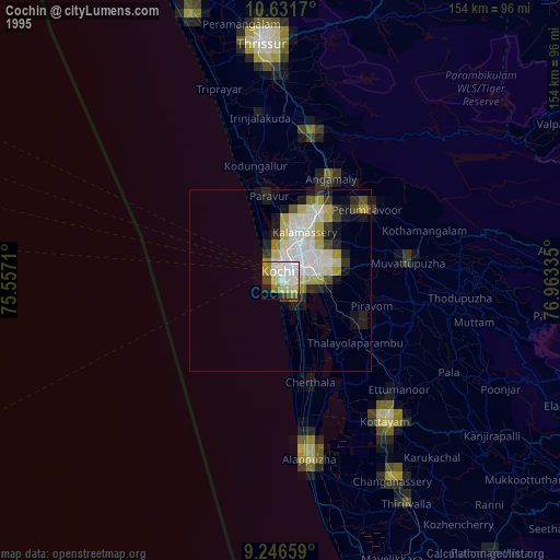
Sources (retrieved 2019-11-25):
» NASA, Earths city lights 1995
» NASA city lights 2003
» Earth at Night: Flat Maps 2012, 2016