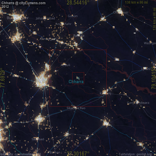
Chharra night lights from space
Night Light of Chharra (Uttar Pradesh) from space (India) Src. Average luminocity for 10x10km area is 23.0492% and for 50x50km: 16.2696%.
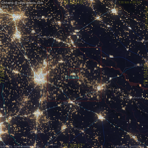
Analysis of Chharra night lights 2016
Square area 10x10 km:
 0.76%
0.76%90-99
0%80-89
1.7%70-79
2.08%60-69
3.98%50-59
6.82%40-49
5.11%30-39
5.87%20-29
6.63%10-19
40.15%0-9
26.89%Square area 50x50 km:
0.2%90-99
0.59%80-89
0.86%70-79
1.02%60-69
2.77%50-59
3.02%40-49
4.44%30-39
5.97%20-29
7.66%10-19
16.36%0-9
57.1%Clear (daylight) street map image can be seen on geolist.org.
Map coordinates:
28° 32' 39" North, 77° 41' 52.4" East
27° 55' 28.9" North, 78° 24' 3.7" East
27° 18' 6" North, 79° 6' 14.9" East
Some cities around Chharra sort by population:
• Alīgarh
32.4 km =20.1 mi,  261°
261°
• Kāsganj
27.3 km =17 mi,  118°
118°
• Atraulī
16.3 km =10.1 mi,  315°
315°
• Sikandra Rao
26.3 km =16.3 mi,  184°
184°
• Naraura
30.8 km =19.1 mi,  357°
357°
• Mārahra
26.6 km =16.5 mi,  141°
141°
• Jalālī
15.9 km =9.9 mi,  246°
246°
• Harduāganj
24 km =14.9 mi,  275°
275°
1274346 (p: 24,535)
Sources (retrieved 2019-11-25):
» Earth at Night: Flat Maps 2012, 2016