Chalāla night lights from space
Night Light of Chalāla (Gujarat) from space (India) Src. Average luminocity for 10x10km area is 4.8239% and for 50x50km: 3.3412%.
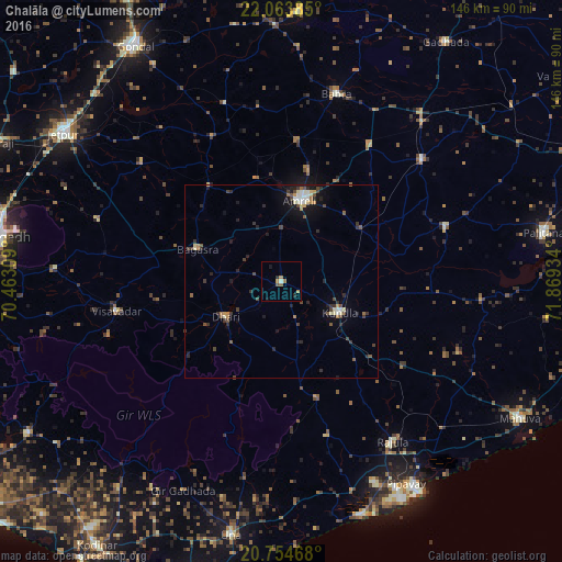
Analysis of Chalāla night lights 2016
Square area 10x10 km:
 0%
0%90-99
0.76%80-89
0%70-79
0.57%60-69
2.27%50-59
1.14%40-49
0.57%30-39
0%20-29
1.52%10-19
1.52%0-9
91.67%Square area 50x50 km:
0.1%90-99
0.53%80-89
0.4%70-79
0.31%60-69
0.42%50-59
0.43%40-49
0.76%30-39
0.77%20-29
1%10-19
1.84%0-9
93.43%Clear (daylight) street map image can be seen on geolist.org.
Map coordinates:
22° 3' 49.9" North, 70° 27' 47.1" East
21° 24' 38.6" North, 71° 9' 58.4" East
20° 45' 16.8" North, 71° 52' 9.6" East
Some cities around Chalāla sort by population:
• Amreli
21.5 km =13.4 mi,  12°
12°
• Kundla
16.4 km =10.2 mi,  117°
117°
• Savarkundla
16.4 km =10.2 mi, 119°
• Gariadhar
44.9 km =27.9 mi,  71°
71°
• Bagasra
23.4 km =14.5 mi,  291°
291°
• Dhāri
17.1 km =10.6 mi,  237°
237°
• Lāthi
41.6 km =25.8 mi,  33°
33°
• Vīsāvadar
43.9 km =27.3 mi,  259°
259°
1274874 (p: 17,081)
Sources (retrieved 2019-11-25):
» Earth at Night: Flat Maps 2012, 2016