Bongaigaon night lights from space
Night Light of Bongaigaon (Assam) from space (India) Src. Average luminocity for 10x10km area is 50.1117% and for 50x50km: 9.0344%.
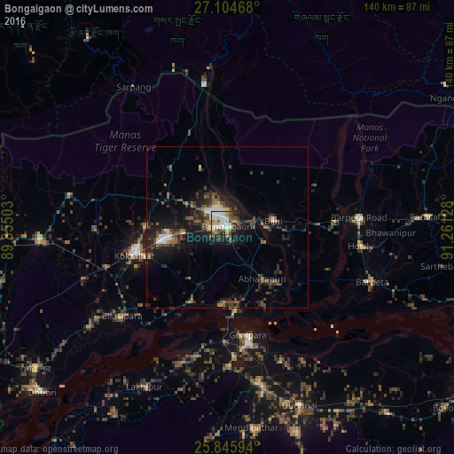
Analysis of Bongaigaon night lights 2016
Square area 10x10 km:
 11.36%
90-99
12.88%80-89
7.01%70-79
2.65%60-69
5.3%50-59
5.68%40-49
6.63%30-39
6.44%20-29
12.5%10-19
22.92%0-9
6.63%Square area 50x50 km:
0.76%90-99
1.2%80-89
0.59%70-79
0.48%60-69
1.1%50-59
1.61%40-49
2.31%30-39
2.04%20-29
4.04%10-19
7.17%0-9
78.68%Clear (daylight) street map image can be seen on geolist.org.
Map coordinates:
27° 6' 16.8" North, 89° 51' 18.1" East
26° 28' 37.3" North, 90° 33' 29.3" East
25° 50' 45.4" North, 91° 15' 40.6" East
Some cities around Bongaigaon sort by population:
• Goālpāra
34.1 km =21.2 mi,  168°
168°
• Barpeta Road
41 km =25.5 mi,  85°
85°
• Kokrajhar
29.6 km =18.4 mi,  253°
253°
• Chāpar
25.3 km =15.7 mi,  206°
206°
• Abhayāpuri
21.3 km =13.2 mi,  143°
143°
• Bijni
14.6 km =9.1 mi,  81°
81°
• Bāsugaon
13.8 km =8.6 mi,  265°
265°
• Sorbhog
32.6 km =20.3 mi, 88°
1275321 (p: 64,902)
Sources (retrieved 2019-11-25):
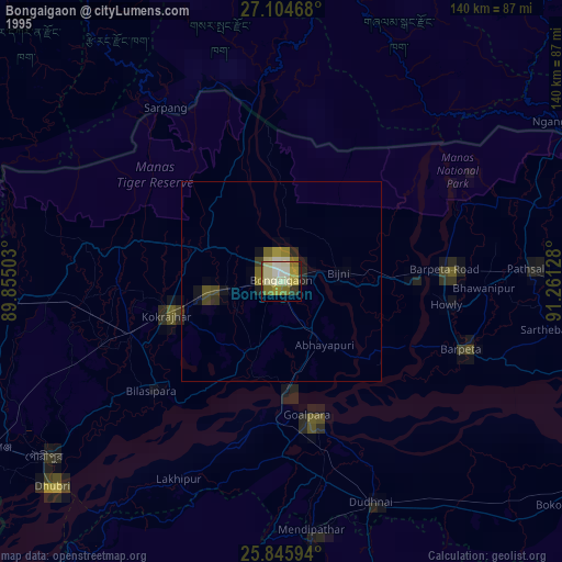
» NASA, Earths city lights 1995
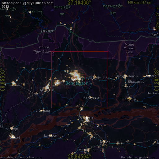
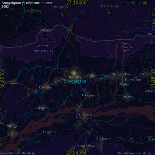
» NASA city lights 2003
» Earth at Night: Flat Maps 2012, 2016