Bāsugaon night lights from space
Night Light of Bāsugaon (Assam) from space (India) Src. Average luminocity for 10x10km area is 26.2708% and for 50x50km: 10.1233%.
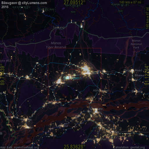
Analysis of Bāsugaon night lights 2016
Square area 10x10 km:
 0.95%
0.95%90-99
2.65%80-89
1.7%70-79
1.7%60-69
3.98%50-59
7.01%40-49
5.49%30-39
8.9%20-29
7.2%10-19
39.02%0-9
21.4%Square area 50x50 km:
0.96%90-99
1.37%80-89
0.64%70-79
0.63%60-69
1.21%50-59
1.8%40-49
2.46%30-39
2.31%20-29
3.89%10-19
8.45%0-9
76.28%Clear (daylight) street map image can be seen on geolist.org.
Map coordinates:
27° 5' 42.4" North, 89° 42' 59" East
26° 28' 2.7" North, 90° 25' 10.2" East
25° 50' 10.6" North, 91° 7' 21.5" East
Some cities around Bāsugaon sort by population:
• Bongaigaon
13.8 km =8.6 mi,  85°
85°
• Goālpāra
38.3 km =23.8 mi,  147°
147°
• Bilāsipāra
32 km =19.9 mi,  215°
215°
• Kokrajhar
16.4 km =10.2 mi,  243°
243°
• Chāpar
21.8 km =13.5 mi,  173°
173°
• Abhayāpuri
31 km =19.3 mi,  121°
121°
• Bijni
28.4 km =17.6 mi,  83°
83°
• Sapatgrām
32.8 km =20.4 mi, 243°
1276728 (p: 12,832)
Sources (retrieved 2019-11-25):
» Earth at Night: Flat Maps 2012, 2016