Bishnāh night lights from space
Night Light of Bishnāh (Jammu and Kashmir) from space (India) Src. Average luminocity for 10x10km area is 87.3531% and for 50x50km: 38.4449%.
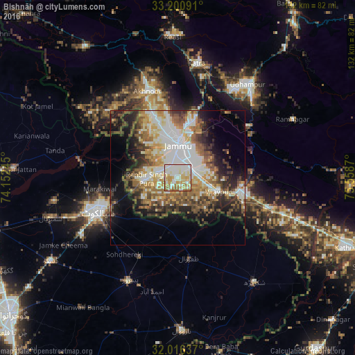
Analysis of Bishnāh night lights 2016
Square area 10x10 km:
 19.06%
90-99
38.81%80-89
13.46%70-79
12.59%60-69
13.99%50-59
2.1%40-49
0%30-39
0%20-29
0%10-19
0%0-9
0%Square area 50x50 km:
6.28%90-99
10.42%80-89
4.33%70-79
4.88%60-69
5.68%50-59
5.7%40-49
5.85%30-39
4.69%20-29
7.09%10-19
9.77%0-9
35.31%Clear (daylight) street map image can be seen on geolist.org.
Map coordinates:
33° 12' 3.3" North, 74° 9' 8.8" East
32° 36' 38.2" North, 74° 51' 20.1" East
32° 0' 58.9" North, 75° 33' 31.3" East
Some cities around Bishnāh sort by population:
• Jammu
14 km =8.7 mi,  5°
5°
• Hadali, PK
27 km =16.8 mi,  277°
277°
• Sāmba
25.3 km =15.7 mi,  102°
102°
• Chawinda, PK
32.8 km =20.4 mi,  205°
205°
• Zafarwal, PK
29.9 km =18.6 mi,  171°
171°
• Akhnūr
30.7 km =19.1 mi,  338°
338°
• Norīa
11.3 km =7 mi, 208°
• Khaur
4.4 km =2.7 mi,  258°
258°
1275466 (p: 11,645)
Sources (retrieved 2019-11-25):
» Earth at Night: Flat Maps 2012, 2016