Bharthana night lights from space
Night Light of Bharthana (Uttar Pradesh) from space (India) Src. Average luminocity for 10x10km area is 57.3413% and for 50x50km: 39.5621%.
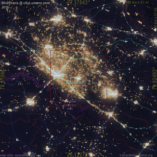
Analysis of Bharthana night lights 2016
Square area 10x10 km:
 4.56%
4.56%90-99
5.36%80-89
9.13%70-79
7.74%60-69
15.28%50-59
16.47%40-49
18.85%30-39
14.48%20-29
8.13%10-19
0%0-9
0%Square area 50x50 km:
1.82%90-99
4.08%80-89
5.17%70-79
5.71%60-69
9.3%50-59
10.7%40-49
10.92%30-39
9.1%20-29
11.87%10-19
12.6%0-9
18.74%Clear (daylight) street map image can be seen on geolist.org.
Map coordinates:
27° 22' 42.3" North, 78° 31' 7.2" East
26° 45' 8.3" North, 79° 13' 18.5" East
26° 7' 21.8" North, 79° 55' 29.7" East
Some cities around Bharthana sort by population:
• Etāwah
20.1 km =12.5 mi,  277°
277°
• Jaswantnagar
34.8 km =21.6 mi,  294°
294°
• Bidhūna
29 km =18 mi,  79°
79°
• Phaphūnd
29.5 km =18.3 mi,  125°
125°
• Bakewar
11 km =6.8 mi,  204°
204°
• Lakhnā
13.7 km =8.5 mi,  212°
212°
• Sarai Ekdil
12.8 km =8 mi,  266°
266°
• Kishni
30.6 km =19 mi,  7°
7°
1276103 (p: 41,055)
Sources (retrieved 2019-11-25):
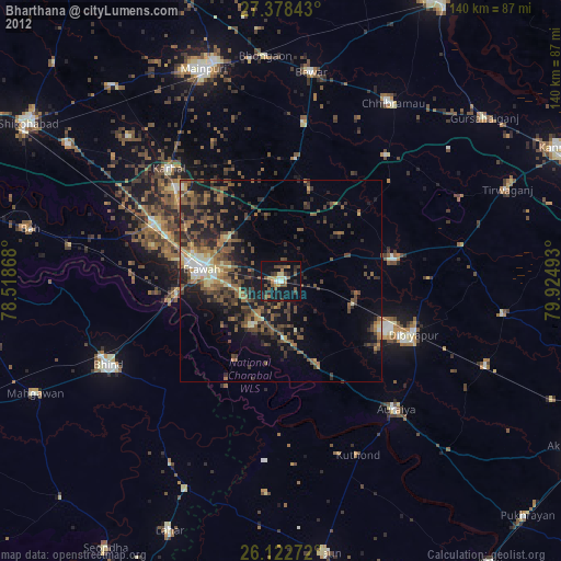
» Earth at Night: Flat Maps 2012, 2016