Bhavnagar night lights from space
Night Light of Bhavnagar (Gujarat) from space (India) Src. Average luminocity for 10x10km area is 71.0258% and for 50x50km: 13.6764%.
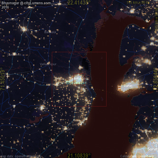
Analysis of Bhavnagar night lights 2016
Square area 10x10 km:
 14.29%
90-99
27.58%80-89
10.52%70-79
8.33%60-69
5.75%50-59
7.54%40-49
5.56%30-39
5.75%20-29
11.9%10-19
2.78%0-9
0%Square area 50x50 km:
0.73%90-99
1.94%80-89
1.7%70-79
1.6%60-69
1.89%50-59
2.55%40-49
2.37%30-39
2.88%20-29
5.66%10-19
11.18%0-9
67.49%Clear (daylight) street map image can be seen on geolist.org.
Map coordinates:
22° 24' 51.8" North, 71° 27' 0.7" East
21° 45' 46.3" North, 72° 9' 11.9" East
21° 6' 30.2" North, 72° 51' 23.2" East
Some cities around Bhavnagar sort by population:
• Pālitāna
43.2 km =26.8 mi,  232°
232°
• Sihor
20.6 km =12.8 mi,  253°
253°
• Talāja
47.2 km =29.3 mi,  194°
194°
• Valabhīpur
31.5 km =19.6 mi,  296°
296°
• Umrāla
37.3 km =23.2 mi,  283°
283°
• Ghogha
15.2 km =9.4 mi,  123°
123°
• Vartej
9.4 km =5.8 mi, 253°
• Dhola
41.4 km =25.7 mi,  288°
288°
1276032 (p: 554,978)
Sources (retrieved 2019-11-25):
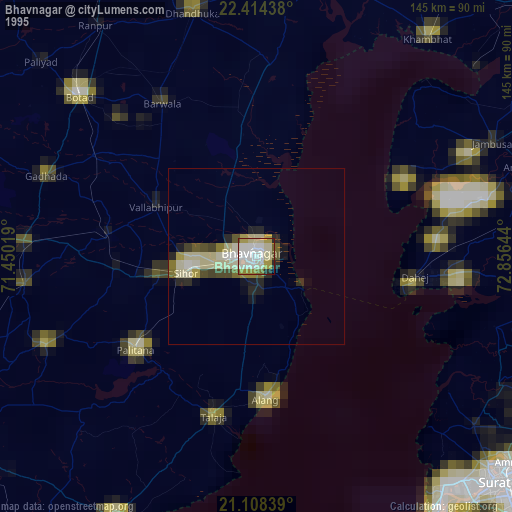
» NASA, Earths city lights 1995
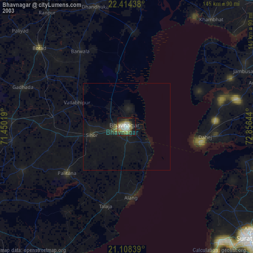
» NASA city lights 2003
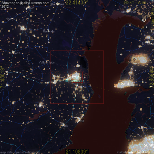
» Earth at Night: Flat Maps 2012, 2016