Farah night lights from space
Night Light of Farah (Uttar Pradesh) from space (India) Src. Average luminocity for 10x10km area is 7.0303% and for 50x50km: 25.0087%.
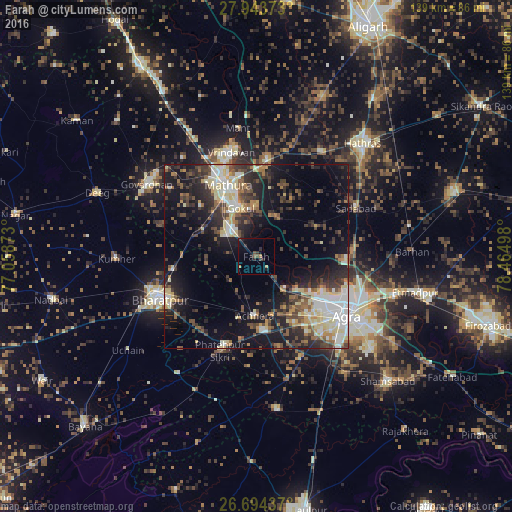
Analysis of Farah night lights 2016
Square area 10x10 km:
 0%
0%90-99
0%80-89
0%70-79
0.95%60-69
1.33%50-59
1.14%40-49
1.14%30-39
2.84%20-29
3.79%10-19
5.11%0-9
83.71%Square area 50x50 km:
3.3%90-99
4.29%80-89
4.14%70-79
1.59%60-69
2.78%50-59
3.26%40-49
4.17%30-39
5.43%20-29
7.97%10-19
15.68%0-9
47.38%Clear (daylight) street map image can be seen on geolist.org.
Map coordinates:
27° 56' 37.4" North, 77° 3' 31.4" East
27° 19' 14.9" North, 77° 45' 42.7" East
26° 41' 39.7" North, 78° 27' 53.9" East
Some cities around Farah sort by population:
• Mathura
22.2 km =13.8 mi,  336°
336°
• Bharatpur
29.2 km =18.1 mi,  246°
246°
• Fatehpur Sīkri
27.2 km =16.9 mi,  201°
201°
• Kiraoli
20.5 km =12.7 mi,  173°
173°
• Achhnera
15.9 km =9.9 mi,  181°
181°
• Rāya
26.3 km =16.3 mi,  6°
6°
• Baldev
11.3 km =7 mi,  31°
31°
• Mahāban
12.6 km =7.8 mi,  351°
351°
1271956 (p: 9,236)
Sources (retrieved 2019-11-25):
» Earth at Night: Flat Maps 2012, 2016