Bhadreswar night lights from space
Night Light of Bhadreswar (West Bengal) from space (India) Src. Average luminocity for 10x10km area is 89.9345% and for 50x50km: 64.0481%.
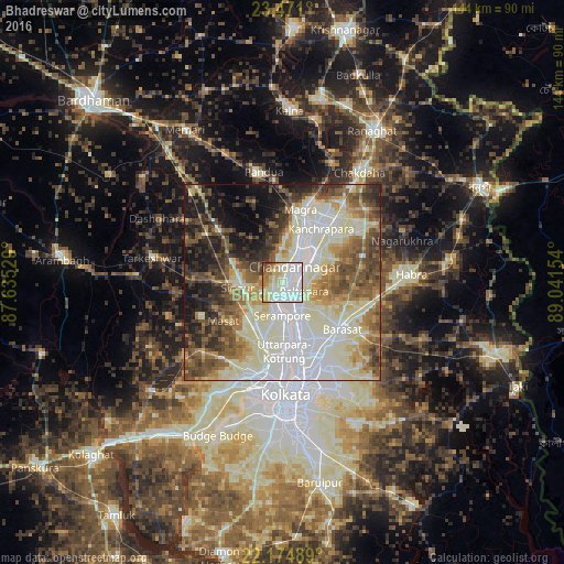
Analysis of Bhadreswar night lights 2016
Square area 10x10 km:
 33.13%
90-99
37.7%80-89
10.12%70-79
5.95%60-69
7.74%50-59
2.18%40-49
2.98%30-39
0.2%20-29
0%10-19
0%0-9
0%Square area 50x50 km:
14.22%90-99
21.13%80-89
7.75%70-79
5.65%60-69
7.61%50-59
8.92%40-49
8.41%30-39
6.58%20-29
6.94%10-19
8.77%0-9
4.02%Clear (daylight) street map image can be seen on geolist.org.
Map coordinates:
23° 28' 15.6" North, 87° 38' 7" East
22° 49' 28.2" North, 88° 20' 18.3" East
22° 10' 29.6" North, 89° 2' 29.5" East
Some cities around Bhadreswar sort by population:
• Bhātpāra
7.9 km =4.9 mi,  54°
54°
• Shyamnagar
3.1 km =1.9 mi,  71°
71°
• Shrīrāmpur
8 km =5 mi,  177°
177°
• Chandannagar
5.2 km =3.2 mi,  35°
35°
• Bārākpur
7 km =4.3 mi,  158°
158°
• Titāgarh
9.8 km =6.1 mi, 158°
• Baidyabāti
4.6 km =2.9 mi,  196°
196°
• Rāmnagar
10.8 km =6.7 mi,  241°
241°
1276320 (p: 121,662)
Sources (retrieved 2019-11-25):
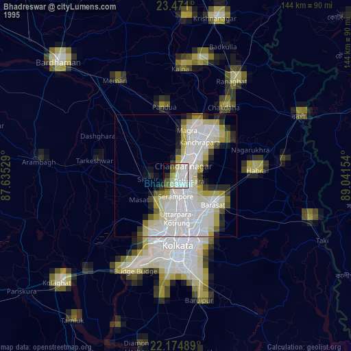
» NASA, Earths city lights 1995
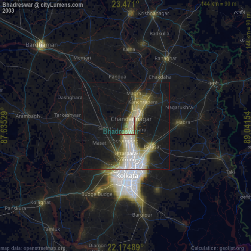
» NASA city lights 2003
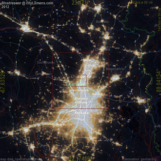
» Earth at Night: Flat Maps 2012, 2016