Baidyabāti night lights from space
Night Light of Baidyabāti (West Bengal) from space (India) Src. Average luminocity for 10x10km area is 92.75% and for 50x50km: 68.336%.
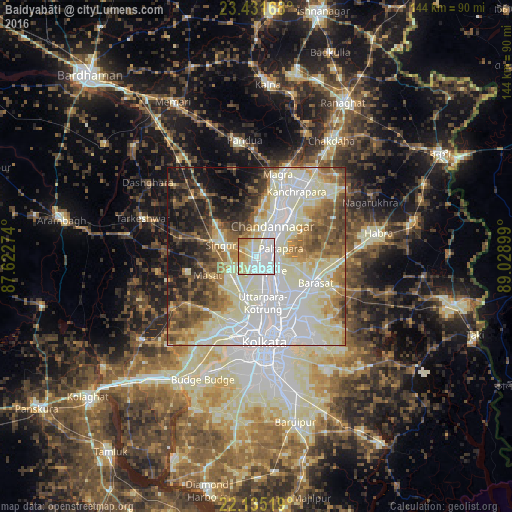
Analysis of Baidyabāti night lights 2016
Square area 10x10 km:
 42.46%
90-99
31.15%80-89
13.69%70-79
8.13%60-69
4.56%50-59
0%40-49
0%30-39
0%20-29
0%10-19
0%0-9
0%Square area 50x50 km:
18.21%90-99
23.16%80-89
8.19%70-79
5.87%60-69
7.22%50-59
7.7%40-49
7.3%30-39
5.49%20-29
5.94%10-19
8.29%0-9
2.63%Clear (daylight) street map image can be seen on geolist.org.
Map coordinates:
23° 25' 54" North, 87° 37' 21.9" East
22° 47' 5.9" North, 88° 19' 33.1" East
22° 8' 6.7" North, 89° 1' 44.4" East
Some cities around Baidyabāti sort by population:
• Shyamnagar
6.8 km =4.2 mi,  37°
37°
• Shrīrāmpur
4 km =2.5 mi,  154°
154°
• Bārākpur
4.4 km =2.7 mi,  118°
118°
• Khardah
9.1 km =5.7 mi,  144°
144°
• Titāgarh
6.8 km =4.2 mi,  134°
134°
• Bhadreswar
4.6 km =2.9 mi,  16°
16°
• Rishra
7.1 km =4.4 mi,  163°
163°
• Rāmnagar
8.2 km =5.1 mi,  264°
264°
1277780 (p: 115,504)
Sources (retrieved 2019-11-25):
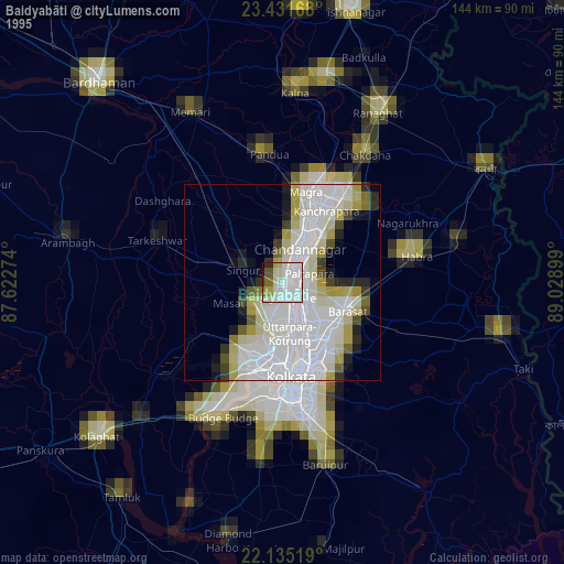
» NASA, Earths city lights 1995
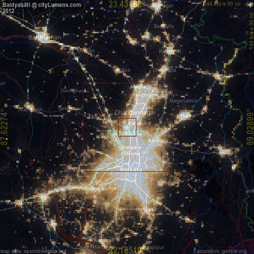
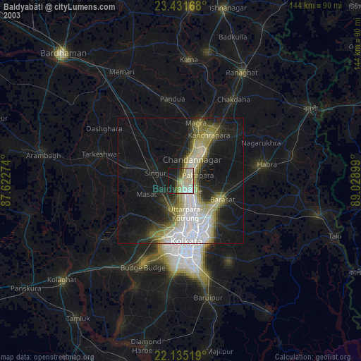
» NASA city lights 2003
» Earth at Night: Flat Maps 2012, 2016