Bhātpāra night lights from space
Night Light of Bhātpāra (West Bengal) from space (India) Src. Average luminocity for 10x10km area is 94.3194% and for 50x50km: 59.7424%.
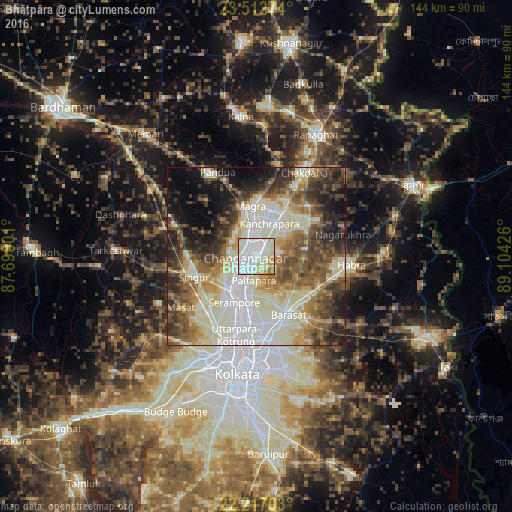
Analysis of Bhātpāra night lights 2016
Square area 10x10 km:
 37.9%
37.9%90-99
45.63%80-89
7.74%70-79
4.76%60-69
3.77%50-59
0.2%40-49
0%30-39
0%20-29
0%10-19
0%0-9
0%Square area 50x50 km:
10.84%90-99
19.78%80-89
7.24%70-79
5.43%60-69
7.37%50-59
9.05%40-49
8.86%30-39
7.76%20-29
8.3%10-19
8.63%0-9
6.73%Clear (daylight) street map image can be seen on geolist.org.
Map coordinates:
23° 30' 45.9" North, 87° 41' 52.8" East
22° 51' 59.1" North, 88° 24' 4.1" East
22° 13' 1.3" North, 89° 6' 15.3" East
Some cities around Bhātpāra sort by population:
• Shyamnagar
5.1 km =3.2 mi,  223°
223°
• Naihāti
3.4 km =2.1 mi,  25°
25°
• Chandannagar
3.4 km =2.1 mi,  262°
262°
• Hugli
4.7 km =2.9 mi,  354°
354°
• Hālīsahar
7.5 km =4.7 mi,  13°
13°
• Bhadreswar
7.9 km =4.9 mi,  234°
234°
• Rāmchandrapur
8.3 km =5.2 mi,  66°
66°
• Sankarpur
5.5 km =3.4 mi,  111°
111°
1276058 (p: 483,129)
Sources (retrieved 2019-11-25):
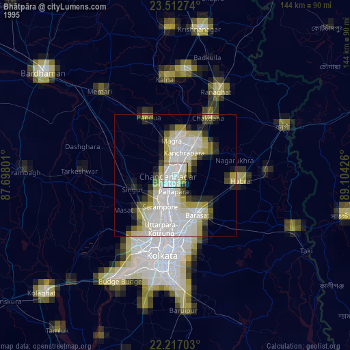
» NASA, Earths city lights 1995
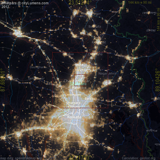
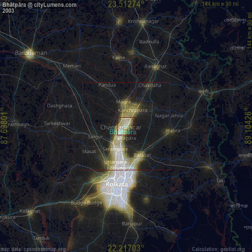
» NASA city lights 2003
» Earth at Night: Flat Maps 2012, 2016