Shrīrāmpur night lights from space
Night Light of Shrīrāmpur (West Bengal) from space (India) Src. Average luminocity for 10x10km area is 97.369% and for 50x50km: 72.4762%.
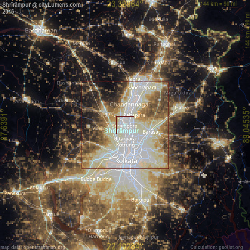
Analysis of Shrīrāmpur night lights 2016
Square area 10x10 km:
 57.74%
90-99
33.73%80-89
7.34%70-79
0.99%60-69
0.2%50-59
0%40-49
0%30-39
0%20-29
0%10-19
0%0-9
0%Square area 50x50 km:
20.33%90-99
24.79%80-89
9.08%70-79
5.96%60-69
7.52%50-59
8.31%40-49
7.18%30-39
5.06%20-29
5.19%10-19
5.32%0-9
1.25%Clear (daylight) street map image can be seen on geolist.org.
Map coordinates:
23° 23' 58.7" North, 87° 38' 20.8" East
22° 45' 10" North, 88° 20' 32" East
22° 6' 10.2" North, 89° 2' 43.3" East
Some cities around Shrīrāmpur sort by population:
• Pānihāti
7.6 km =4.7 mi,  154°
154°
• Bārākpur
2.6 km =1.6 mi,  55°
55°
• Khardah
5.3 km =3.3 mi,  135°
135°
• Titāgarh
3.4 km =2.1 mi,  109°
109°
• Rishra
3.2 km =2 mi,  173°
173°
• Baidyabāti
4 km =2.5 mi,  334°
334°
• Konnagar
5.3 km =3.3 mi,  177°
177°
• Sodpur
7.4 km =4.6 mi, 136°
1256422 (p: 226,317)
Sources (retrieved 2019-11-25):
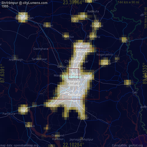
» NASA, Earths city lights 1995
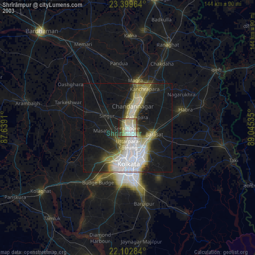
» NASA city lights 2003
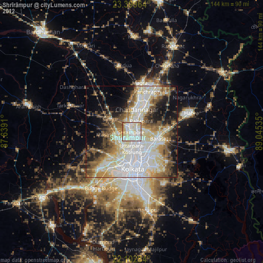
» Earth at Night: Flat Maps 2012, 2016