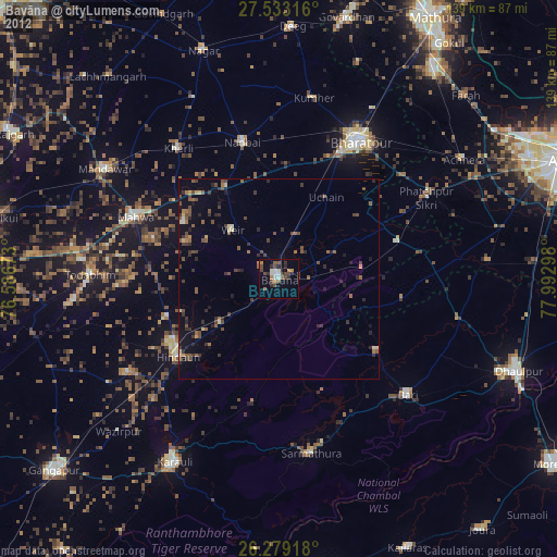
Bayāna night lights from space
Night Light of Bayāna (Rajasthan) from space (India) Src. Average luminocity for 10x10km area is 19.5298% and for 50x50km: 8.8295%.
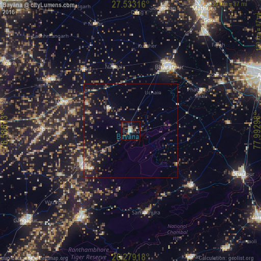
Analysis of Bayāna night lights 2016
Square area 10x10 km:
 0.2%
0.2%90-99
3.17%80-89
4.56%70-79
0%60-69
0.79%50-59
4.56%40-49
4.96%30-39
5.75%20-29
1.59%10-19
11.51%0-9
62.9%Square area 50x50 km:
0.13%90-99
0.69%80-89
1.02%70-79
0.63%60-69
1.16%50-59
1.8%40-49
2.44%30-39
2.45%20-29
2.93%10-19
7.16%0-9
79.58%Clear (daylight) street map image can be seen on geolist.org.
Map coordinates:
27° 31' 59.4" North, 76° 35' 12.2" East
26° 54' 28.5" North, 77° 17' 23.5" East
26° 16' 45" North, 77° 59' 34.7" East
Some cities around Bayāna sort by population:
• Bharatpur
39.7 km =24.7 mi,  29°
29°
• Hindaun
31.8 km =19.8 mi,  232°
232°
• Fatehpur Sīkri
42.1 km =26.2 mi,  60°
60°
• Nādbai
36.2 km =22.5 mi,  345°
345°
• Mahwah
38.7 km =24 mi,  293°
293°
• Bhasāwar
28 km =17.4 mi,  301°
301°
• Wer
16.7 km =10.4 mi,  317°
317°
• Jagnair
31.4 km =19.5 mi,  99°
99°
1276652 (p: 36,399)
Sources (retrieved 2019-11-25):
» Earth at Night: Flat Maps 2012, 2016