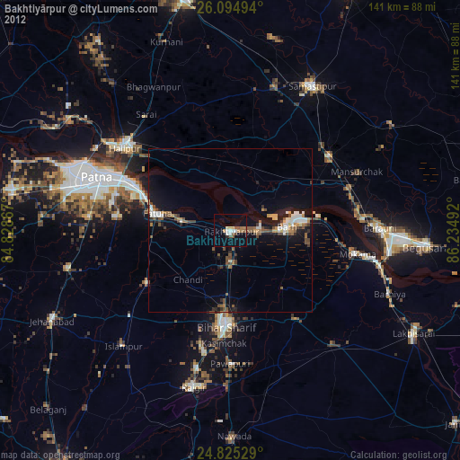
Bakhtiyārpur night lights from space
Night Light of Bakhtiyārpur (Bihar) from space (India) Src. Average luminocity for 10x10km area is 32.8948% and for 50x50km: 43.5937%.
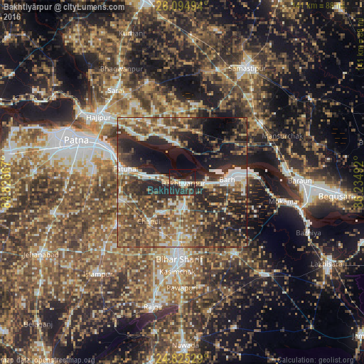
Analysis of Bakhtiyārpur night lights 2016
Square area 10x10 km:
 2.98%
2.98%90-99
4.17%80-89
2.58%70-79
3.37%60-69
3.77%50-59
4.76%40-49
1.79%30-39
9.92%20-29
32.14%10-19
26.39%0-9
8.13%Square area 50x50 km:
4.74%90-99
6.59%80-89
4.64%70-79
5.67%60-69
6.61%50-59
9.64%40-49
10.96%30-39
9.97%20-29
16.35%10-19
14%0-9
10.83%Clear (daylight) street map image can be seen on geolist.org.
Map coordinates:
26° 5' 41.8" North, 84° 49' 43.2" East
25° 27' 42.4" North, 85° 31' 54.4" East
24° 49' 31" North, 86° 14' 5.7" East
Some cities around Bakhtiyārpur sort by population:
• Bihār Sharīf
29 km =18 mi,  181°
181°
• Bārh
18 km =11.2 mi,  82°
82°
• Bar Bigha
33.8 km =21 mi,  143°
143°
• Fatwa
23.4 km =14.5 mi,  283°
283°
• Hilsa
29.8 km =18.5 mi,  237°
237°
• Dalsingh Sarai
38.2 km =23.7 mi,  53°
53°
• Mohiuddinnagar
18.6 km =11.6 mi, 47°
• Khusropur
14.9 km =9.3 mi, 278°
1277684 (p: 34,533)
Sources (retrieved 2019-11-25):
» Earth at Night: Flat Maps 2012, 2016