Tālbahat night lights from space
Night Light of Tālbahat (Uttar Pradesh) from space (India) Src. Average luminocity for 10x10km area is 24.8902% and for 50x50km: 5.7103%.
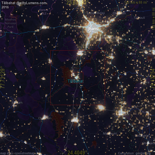
Analysis of Tālbahat night lights 2016
Square area 10x10 km:
 3.22%
3.22%90-99
7.39%80-89
0.76%70-79
1.52%60-69
2.65%50-59
3.41%40-49
3.79%30-39
3.41%20-29
4.73%10-19
21.78%0-9
47.35%Square area 50x50 km:
0.46%90-99
0.81%80-89
0.24%70-79
0.37%60-69
0.83%50-59
1%40-49
0.84%30-39
1.28%20-29
1.84%10-19
4.61%0-9
87.72%Clear (daylight) street map image can be seen on geolist.org.
Map coordinates:
25° 40' 44.1" North, 77° 43' 52.6" East
25° 2' 36.9" North, 78° 26' 3.9" East
24° 24' 17.6" North, 79° 8' 15.1" East
Some cities around Tālbahat sort by population:
• Jhānsi
48.4 km =30.1 mi,  17°
17°
• Lalitpur
39.3 km =24.4 mi,  182°
182°
• Tīkamgarh
52.1 km =32.4 mi,  129°
129°
• Babīna
22.1 km =13.7 mi,  9°
9°
• Chanderi
47.4 km =29.5 mi,  219°
219°
• Bāmor Kalān
33.1 km =20.6 mi,  239°
239°
• Khailār
34.5 km =21.4 mi, 16°
• Orchha
40.1 km =24.9 mi,  31°
31°
1255146 (p: 13,789)
Sources (retrieved 2019-11-25):
» Earth at Night: Flat Maps 2012, 2016