Ambad night lights from space
Night Light of Ambad (Maharashtra) from space (India) Src. Average luminocity for 10x10km area is 10.8636% and for 50x50km: 6.7879%.
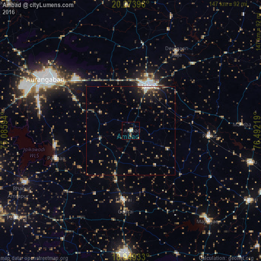
Analysis of Ambad night lights 2016
Square area 10x10 km:
 0.41%
0.41%90-99
2.27%80-89
0.62%70-79
2.48%60-69
1.45%50-59
1.03%40-49
1.65%30-39
0.83%20-29
3.72%10-19
1.65%0-9
83.88%Square area 50x50 km:
0.21%90-99
0.59%80-89
0.52%70-79
0.78%60-69
0.93%50-59
1.61%40-49
1.6%30-39
1.79%20-29
1.94%10-19
3.07%0-9
86.96%Clear (daylight) street map image can be seen on geolist.org.
Map coordinates:
20° 16' 26.3" North, 75° 5' 9.4" East
19° 36' 46.8" North, 75° 47' 20.6" East
18° 56' 57.6" North, 76° 29' 31.9" East
Some cities around Ambad sort by population:
• Aurangabad
55.2 km =34.3 mi,  302°
302°
• Jālna
27.3 km =17 mi,  21°
21°
• Paithan
45 km =28 mi,  250°
250°
• Partūr
44.7 km =27.8 mi,  91°
91°
• Gevrai
39.1 km =24.3 mi,  186°
186°
• Deūlgaon Rāja
52 km =32.3 mi,  30°
30°
• Pīpri
33.3 km =20.7 mi,  307°
307°
• Ashti
52.7 km =32.7 mi,  119°
119°
1278871 (p: 29,846)
Sources (retrieved 2019-11-25):
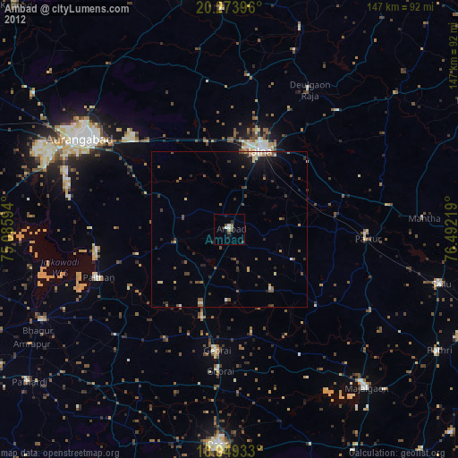
» Earth at Night: Flat Maps 2012, 2016