Asarganj night lights from space
Night Light of Asarganj (Bihar) from space (India) Src. Average luminocity for 10x10km area is 43.5456% and for 50x50km: 22.4995%.
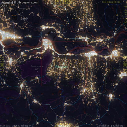
Analysis of Asarganj night lights 2016
Square area 10x10 km:
 1.79%
1.79%90-99
4.96%80-89
2.98%70-79
2.98%60-69
5.16%50-59
13.29%40-49
16.67%30-39
23.21%20-29
23.02%10-19
5.95%0-9
0%Square area 50x50 km:
1.8%90-99
2.32%80-89
1.62%70-79
1.56%60-69
2.83%50-59
4.17%40-49
5.87%30-39
6.61%20-29
10.74%10-19
22.89%0-9
39.59%Clear (daylight) street map image can be seen on geolist.org.
Map coordinates:
25° 47' 6.9" North, 85° 58' 59.8" East
25° 9' 1.7" North, 86° 41' 11" East
24° 30' 44.5" North, 87° 23' 22.3" East
Some cities around Asarganj sort by population:
• Bhāgalpur
30.6 km =19 mi,  70°
70°
• Monghyr
32.8 km =20.4 mi,  319°
319°
• Jamālpur
26.8 km =16.7 mi,  312°
312°
• Khagaria
44.9 km =27.9 mi,  330°
330°
• Bānka
38.3 km =23.8 mi,  141°
141°
• Kharagpur
13.5 km =8.4 mi,  257°
257°
• Amarpur
25 km =15.5 mi,  119°
119°
• Bariārpur
18.9 km =11.7 mi, 324°
1278308 (p: 6,020)
Sources (retrieved 2019-11-25):
» Earth at Night: Flat Maps 2012, 2016