Rāichūr night lights from space
Night Light of Rāichūr (Karnataka) from space (India) Src. Average luminocity for 10x10km area is 72.0826% and for 50x50km: 13.1714%.
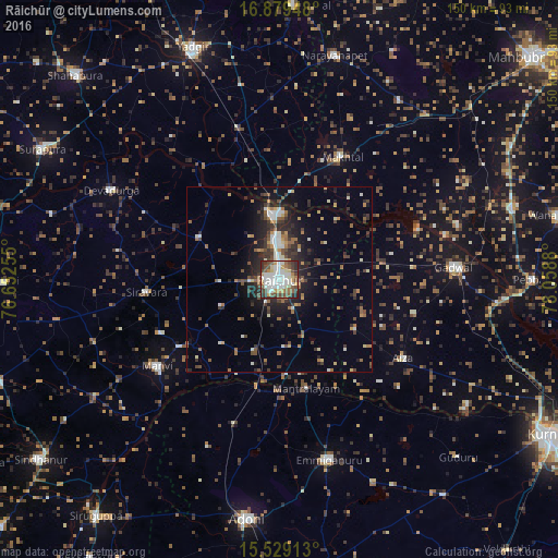
Analysis of Rāichūr night lights 2016
Square area 10x10 km:
 18.8%
18.8%90-99
22.52%80-89
7.64%70-79
7.64%60-69
5.79%50-59
10.54%40-49
11.57%30-39
6.82%20-29
8.68%10-19
0%0-9
0%Square area 50x50 km:
1.39%90-99
2.11%80-89
0.94%70-79
1.4%60-69
1.85%50-59
2.1%40-49
2.27%30-39
2.72%20-29
4.08%10-19
6.99%0-9
74.15%Clear (daylight) street map image can be seen on geolist.org.
Map coordinates:
16° 52' 46.1" North, 76° 39' 9.2" East
16° 12' 19.7" North, 77° 21' 20.4" East
15° 31' 44.9" North, 78° 3' 31.7" East
Some cities around Rāichūr sort by population:
• Ādoni
64.8 km =40.3 mi,  187°
187°
• Emmiganūr
50.1 km =31.1 mi,  164°
164°
• Yādgīr
66.9 km =41.6 mi,  339°
339°
• Gadwāl
47.1 km =29.3 mi,  85°
85°
• Shorāpur
72.8 km =45.2 mi,  298°
298°
• Mānvi
40.4 km =25.1 mi,  233°
233°
• Nārāyanpet
62.1 km =38.6 mi,  13°
13°
• Kosigi
40.7 km =25.3 mi,  196°
196°
1259012 (p: 225,962)
Sources (retrieved 2019-11-25):
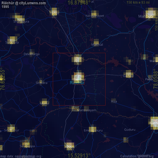
» NASA, Earths city lights 1995
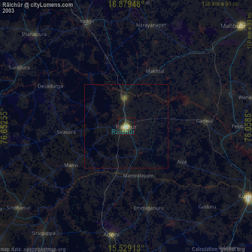
» NASA city lights 2003
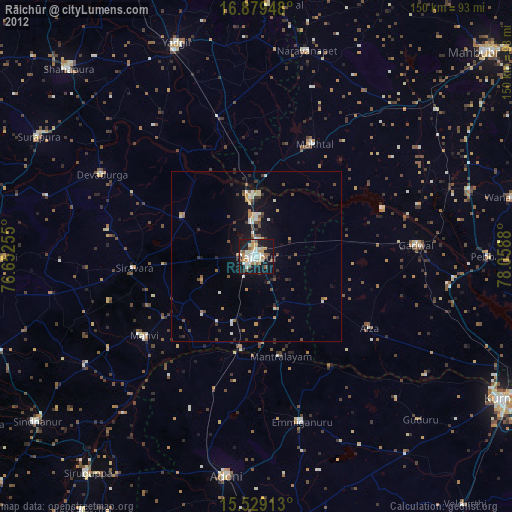
» Earth at Night: Flat Maps 2012, 2016