Kiryat Gat night lights from space
Night Light of Kiryat Gat (Southern District) from space (Israel) Src. Average luminocity for 10x10km area is 62.337% and for 50x50km: 44.467%.
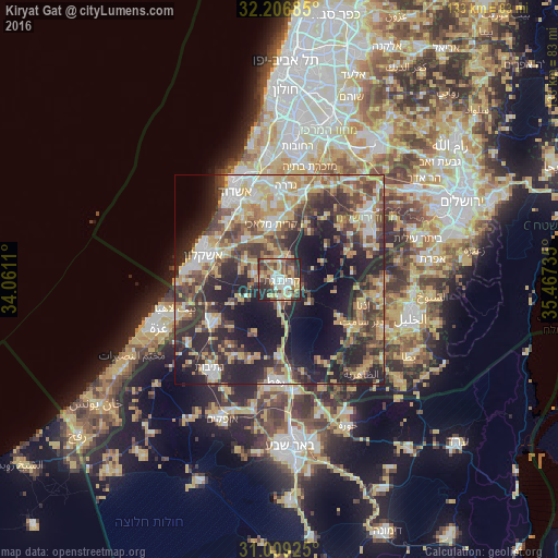
Analysis of Kiryat Gat night lights 2016
Square area 10x10 km:
 10.07%
90-99
11.17%80-89
13.19%70-79
10.44%60-69
5.68%50-59
9.34%40-49
14.65%30-39
11.9%20-29
12.09%10-19
1.47%0-9
0%Square area 50x50 km:
5.67%90-99
6.2%80-89
8.12%70-79
8.23%60-69
4.49%50-59
5.9%40-49
9.69%30-39
8.36%20-29
14.34%10-19
18.02%0-9
10.98%Clear (daylight) street map image can be seen on geolist.org.
Map coordinates:
32° 12' 24.7" North, 34° 3' 40" East
31° 36' 35.9" North, 34° 45' 51.2" East
31° 0' 33.3" North, 35° 28' 2.5" East
Some cities around Kiryat Gat sort by population:
• Ashkelon
19.4 km =12.1 mi,  289°
289°
• Gedera
22.8 km =14.2 mi,  3°
3°
• Gan Yavne
20.5 km =12.7 mi,  344°
344°
• Sederot
18.5 km =11.5 mi,  239°
239°
• Idhnā, PS
20.7 km =12.9 mi,  105°
105°
• Bayt ‘Awwā, PS
20.8 km =12.9 mi,  122°
122°
• Bnei Ayish
19.3 km =12 mi,  356°
356°
• Dayr Sāmit, PS
22.3 km =13.9 mi, 116°
293842 (p: 47,450)
Sources (retrieved 2019-11-25):
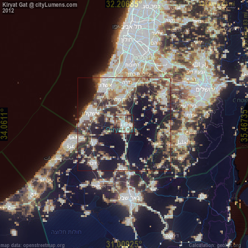
» Earth at Night: Flat Maps 2012, 2016