Idhnā night lights from space
Night Light of Idhnā (West Bank) from space (Palestinian Territory) Src. Average luminocity for 10x10km area is 48.201% and for 50x50km: 43.8741%.
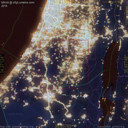
Analysis of Idhnā night lights 2016
Square area 10x10 km:
 1.22%
1.22%90-99
1.22%80-89
8.57%70-79
16.08%60-69
9.97%50-59
8.39%40-49
12.59%30-39
14.34%20-29
11.01%10-19
16.08%0-9
0.52%Square area 50x50 km:
5%90-99
5.41%80-89
7.12%70-79
10.21%60-69
4.59%50-59
6.94%40-49
9.91%30-39
9.04%20-29
11.65%10-19
16.18%0-9
13.93%Clear (daylight) street map image can be seen on geolist.org.
Map coordinates:
32° 9' 21.4" North, 34° 16' 16.5" East
31° 33' 31.5" North, 34° 58' 27.7" East
30° 57' 27.7" North, 35° 40' 39" East
Some cities around Idhnā sort by population:
• Dūrā
7.7 km =4.8 mi,  137°
137°
• Tarqūmyā
4 km =2.5 mi,  62°
62°
• Taffūḩ
7.5 km =4.7 mi,  107°
107°
• Bayt Ūlā
6.7 km =4.2 mi,  51°
51°
• Bayt ‘Awwā
6 km =3.7 mi,  203°
203°
• Khārās
8.9 km =5.5 mi, 45°
• Dayr Sāmit
4.2 km =2.6 mi,  179°
179°
• Bayt Kāḩil
8.7 km =5.4 mi,  81°
81°
283621 (p: 18,727)
Sources (retrieved 2019-11-25):
» Earth at Night: Flat Maps 2012, 2016