Iksāl night lights from space
Night Light of Iksāl (Northern District) from space (Israel) Src. Average luminocity for 10x10km area is 76.7832% and for 50x50km: 56.6197%.
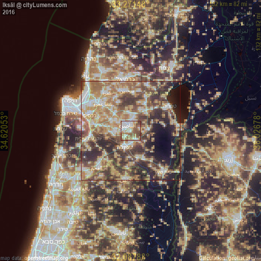
Analysis of Iksāl night lights 2016
Square area 10x10 km:
 18.71%
90-99
20.28%80-89
11.54%70-79
5.59%60-69
15.73%50-59
20.63%40-49
6.12%30-39
1.4%20-29
0%10-19
0%0-9
0%Square area 50x50 km:
6.92%90-99
8.83%80-89
12.96%70-79
9.43%60-69
9.55%50-59
8.65%40-49
10.94%30-39
11.18%20-29
10.13%10-19
7.52%0-9
3.9%Clear (daylight) street map image can be seen on geolist.org.
Map coordinates:
33° 16' 17.3" North, 34° 37' 13.9" East
32° 40' 53.9" North, 35° 19' 25.1" East
32° 5' 16.4" North, 36° 1' 36.4" East
Some cities around Iksāl sort by population:
• Nazareth
3.2 km =2 mi,  310°
310°
• Afula
8.7 km =5.4 mi,  201°
201°
• Migdal Ha‘Emeq
7.9 km =4.9 mi,  265°
265°
• Kafr Kannā
7.4 km =4.6 mi,  13°
13°
• Er Reina
4.7 km =2.9 mi,  351°
351°
• Dabbūrīya
4.6 km =2.9 mi,  74°
74°
• Bu‘eina
14.4 km =8.9 mi,  15°
15°
• Bīr el Maksūr
14.4 km =8.9 mi,  317°
317°
294658 (p: 11,398)
Sources (retrieved 2019-11-25):
» Earth at Night: Flat Maps 2012, 2016