Migdal Ha‘Emeq night lights from space
Night Light of Migdal Ha‘Emeq (Northern District) from space (Israel) Src. Average luminocity for 10x10km area is 75.3811% and for 50x50km: 60.5101%.
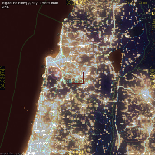
Analysis of Migdal Ha‘Emeq night lights 2016
Square area 10x10 km:
 13.46%
90-99
16.61%80-89
19.41%70-79
15.03%60-69
12.94%50-59
9.62%40-49
5.24%30-39
5.24%20-29
2.45%10-19
0%0-9
0%Square area 50x50 km:
9.02%90-99
9.79%80-89
12.96%70-79
9.53%60-69
9.95%50-59
9.64%40-49
11.73%30-39
12.12%20-29
10.26%10-19
2.97%0-9
2.03%Clear (daylight) street map image can be seen on geolist.org.
Map coordinates:
33° 15' 57.1" North, 34° 32' 12.3" East
32° 40' 33.5" North, 35° 14' 23.5" East
32° 4' 55.8" North, 35° 56' 34.8" East
Some cities around Migdal Ha‘Emeq sort by population:
• Nazareth
6 km =3.7 mi,  63°
63°
• Afula
8.8 km =5.5 mi,  148°
148°
• Kafr Kannā
12.4 km =7.7 mi,  50°
50°
• Er Reina
8.9 km =5.5 mi, 53°
• Iksāl
7.9 km =4.9 mi,  85°
85°
• Bīr el Maksūr
11.4 km =7.1 mi,  350°
350°
• Basmat Ṭab‘ūn
10.4 km =6.5 mi,  312°
312°
• Ramat Yishay
7.2 km =4.5 mi,  296°
296°
294210 (p: 24,800)
Sources (retrieved 2019-11-25):
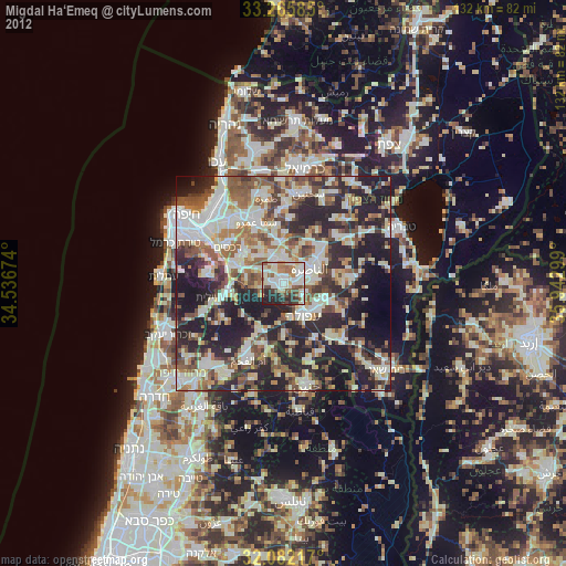
» Earth at Night: Flat Maps 2012, 2016