Bet Shemesh night lights from space
Night Light of Bet Shemesh (Jerusalem) from space (Israel) Src. Average luminocity for 10x10km area is 64.2637% and for 50x50km: 61.7623%.
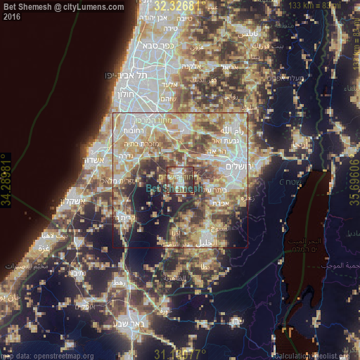
Analysis of Bet Shemesh night lights 2016
Square area 10x10 km:
 12.82%
90-99
13.37%80-89
10.99%70-79
6.23%60-69
5.31%50-59
10.99%40-49
19.05%30-39
14.29%20-29
6.96%10-19
0%0-9
0%Square area 50x50 km:
12.32%90-99
12.54%80-89
12.81%70-79
11.81%60-69
6.31%50-59
8.18%40-49
8.64%30-39
6.72%20-29
6.29%10-19
8.16%0-9
6.21%Clear (daylight) street map image can be seen on geolist.org.
Map coordinates:
32° 19' 36.5" North, 34° 17' 23.3" East
31° 43' 50.6" North, 34° 59' 34.5" East
31° 7' 50.8" North, 35° 41' 45.8" East
Some cities around Bet Shemesh sort by population:
• Şūrīf, PS
11.2 km =7 mi,  142°
142°
• Bayt Ūmmar, PS
15.9 km =9.9 mi, 138°
• Bayt Ūlā, PS
15.4 km =9.6 mi,  166°
166°
• Qaţanah, PS
16.5 km =10.3 mi,  46°
46°
• Khārās, PS
13.7 km =8.5 mi,  160°
160°
• Naḩḩālīn, PS
13.1 km =8.1 mi,  112°
112°
• Abū Ghaush
13.8 km =8.6 mi, 52°
• Ḩūsān, PS
13.6 km =8.5 mi,  100°
100°
295432 (p: 67,100)
Sources (retrieved 2019-11-25):
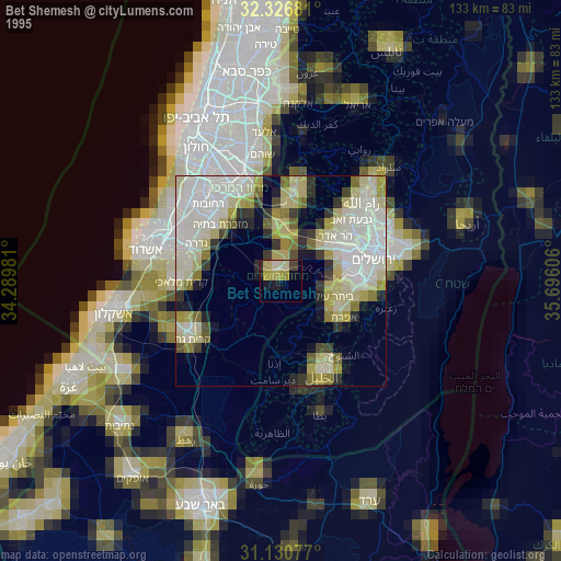
» NASA, Earths city lights 1995
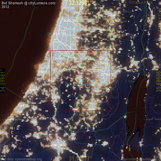
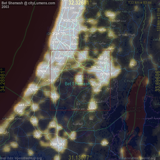
» NASA city lights 2003
» Earth at Night: Flat Maps 2012, 2016