Abū Ghaush night lights from space
Night Light of Abū Ghaush (Jerusalem) from space (Israel) Src. Average luminocity for 10x10km area is 74.1703% and for 50x50km: 57.8278%.
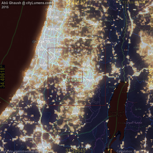
Analysis of Abū Ghaush night lights 2016
Square area 10x10 km:
 15.93%
90-99
16.3%80-89
12.27%70-79
16.85%60-69
6.59%50-59
14.1%40-49
13.92%30-39
4.03%20-29
0%10-19
0%0-9
0%Square area 50x50 km:
10.92%90-99
11.15%80-89
11.22%70-79
10.07%60-69
6.4%50-59
9.05%40-49
9.81%30-39
7.56%20-29
7.25%10-19
7.49%0-9
9.08%Clear (daylight) street map image can be seen on geolist.org.
Map coordinates:
32° 24' 5.5" North, 34° 24' 22.2" East
31° 48' 21.3" North, 35° 6' 33.5" East
31° 12' 23.2" North, 35° 48' 44.7" East
Some cities around Abū Ghaush sort by population:
• Jerusalem
10.9 km =6.8 mi,  112°
112°
• West Jerusalem
10.8 km =6.7 mi,  104°
104°
• Mevasseret Ẕiyyon
3.9 km =2.4 mi, 96°
• Givat Zeev, PS
8.3 km =5.2 mi,  42°
42°
• Bayt Liqyā, PS
8.2 km =5.1 mi,  329°
329°
• Qaţanah, PS
3.2 km =2 mi,  16°
16°
• Biddū, PS
5 km =3.1 mi,  49°
49°
• Kharbathā al Mişbāḩ, PS
9.5 km =5.9 mi,  338°
338°
295772 (p: 5,707)
Sources (retrieved 2019-11-25):
» Earth at Night: Flat Maps 2012, 2016