Knocklyon night lights from space
Night Light of Knocklyon (Leinster) from space (Ireland) Src. Average luminocity for 10x10km area is 69.6679% and for 50x50km: 23.882%.
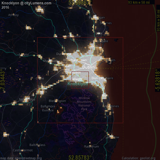
Analysis of Knocklyon night lights 2016
Square area 10x10 km:
 28.28%
90-99
26.14%80-89
4.42%70-79
1.52%60-69
1.77%50-59
0.63%40-49
3.16%30-39
7.95%20-29
15.03%10-19
11.11%0-9
0%Square area 50x50 km:
8.23%90-99
5.44%80-89
1.71%70-79
1.77%60-69
1.74%50-59
1.69%40-49
2.26%30-39
2.68%20-29
5.11%10-19
10.35%0-9
59.01%Clear (daylight) street map image can be seen on geolist.org.
Map coordinates:
53° 41' 55.1" North, 7° 2' 3.9" West
53° 16' 49.1" North, 6° 19' 52.7" West
52° 51' 28.2" North, 5° 37' 41.4" West
Some cities around Knocklyon sort by population:
• Tallaght
2.9 km =1.8 mi,  282°
282°
• Dundrum
5.1 km =3.2 mi,  76°
76°
• Crumlin
4.7 km =2.9 mi,  13°
13°
• Oldbawn
2.5 km =1.6 mi,  257°
257°
• Ballyboden
1 km =0.6 mi,  88°
88°
• Terenure
4.5 km =2.8 mi,  43°
43°
• Templeogue
2.2 km =1.4 mi, 41°
• Firhouse
0.5 km =0.3 mi,  286°
286°
7838921 (p: 14,628)
Sources (retrieved 2019-11-25):
» Earth at Night: Flat Maps 2012, 2016