Athy night lights from space
Night Light of Athy (Leinster) from space (Ireland) Src. Average luminocity for 10x10km area is 6.2672% and for 50x50km: 3.7818%.
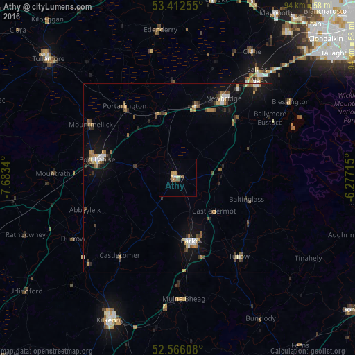
Analysis of Athy night lights 2016
Square area 10x10 km:
 0.66%
0.66%90-99
0.4%80-89
1.06%70-79
1.59%60-69
1.19%50-59
1.19%40-49
0.79%30-39
0%20-29
0%10-19
0%0-9
93.12%Square area 50x50 km:
0.36%90-99
0.47%80-89
0.34%70-79
0.42%60-69
0.66%50-59
0.6%40-49
0.62%30-39
0.56%20-29
0.54%10-19
2.41%0-9
93.03%Clear (daylight) street map image can be seen on geolist.org.
Map coordinates:
53° 24' 45.2" North, 7° 41' 0.2" West
52° 59' 29" North, 6° 58' 49" West
52° 33' 57.9" North, 6° 16' 37.7" West
Some cities around Athy sort by population:
• Naas
32.6 km =20.3 mi,  39°
39°
• Carlow
17.1 km =10.6 mi,  167°
167°
• Droichead Nua
24.5 km =15.2 mi,  30°
30°
• Portlaoise
21.9 km =13.6 mi,  282°
282°
• Kildare
18.8 km =11.7 mi,  13°
13°
• Portarlington
23.6 km =14.7 mi,  323°
323°
• Cherryville
18.4 km =11.4 mi,  2°
2°
• Sallins
35.5 km =22.1 mi, 36°
2966837 (p: 12,855)
Sources (retrieved 2019-11-25):
» Earth at Night: Flat Maps 2012, 2016