Sukabumi night lights from space
Night Light of Sukabumi (West Java) from space (Indonesia) Src. Average luminocity for 10x10km area is 43.842% and for 50x50km: 11.6483%.
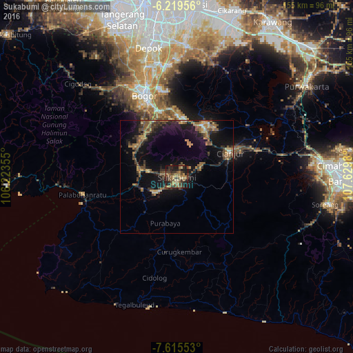
Analysis of Sukabumi night lights 2016
Square area 10x10 km:
 0%
0%90-99
0%80-89
8.44%70-79
9.09%60-69
13.2%50-59
10.17%40-49
14.29%30-39
9.31%20-29
13.64%10-19
21.43%0-9
0.43%Square area 50x50 km:
0.12%90-99
0.43%80-89
1.35%70-79
1.7%60-69
2.53%50-59
2.42%40-49
2.94%30-39
2.13%20-29
3.12%10-19
12.3%0-9
70.96%Clear (daylight) street map image can be seen on geolist.org.
Map coordinates:
6° 13' 10.4" South, 106° 13' 24.8" East
6° 55' 5" South, 106° 55' 36" East
7° 36' 55.9" South, 107° 37' 47.3" East
Some cities around Sukabumi sort by population:
• Bogor
39.1 km =24.3 mi,  337°
337°
• Ciampea
47.5 km =29.5 mi,  328°
328°
• Cibinong
49.2 km =30.6 mi,  350°
350°
• Citeureup
48.3 km =30 mi, 354°
• Caringin
26.3 km =16.3 mi, 333°
• Cicurug
22 km =13.7 mi,  313°
313°
• Ciranjang-hilir
38.1 km =23.7 mi,  73°
73°
• Pelabuhanratu
42.1 km =26.2 mi,  259°
259°
1626381 (p: 276,414)
Sources (retrieved 2019-11-25):
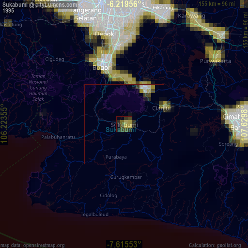
» NASA, Earths city lights 1995
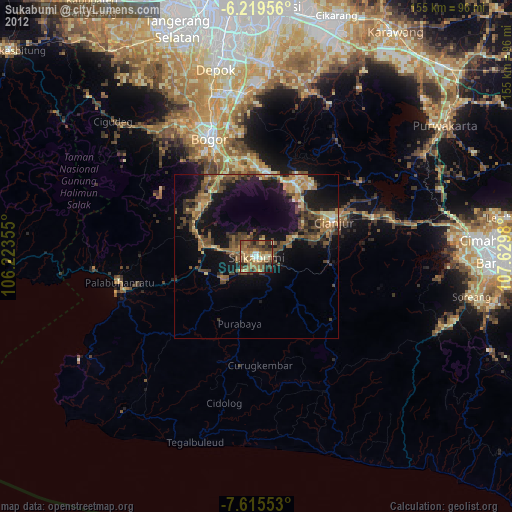
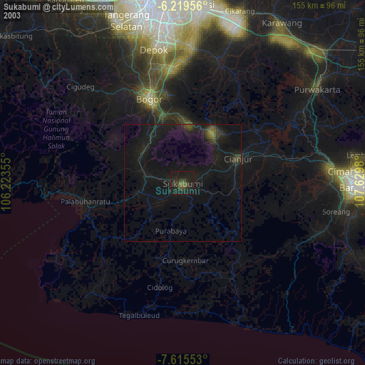
» NASA city lights 2003
» Earth at Night: Flat Maps 2012, 2016