Ciampea night lights from space
Night Light of Ciampea (West Java) from space (Indonesia) Src. Average luminocity for 10x10km area is 39.8442% and for 50x50km: 37.3219%.
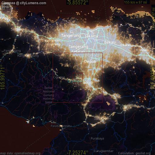
Analysis of Ciampea night lights 2016
Square area 10x10 km:
 0%
0%90-99
1.08%80-89
2.38%70-79
2.6%60-69
4.76%50-59
22.94%40-49
19.7%30-39
14.07%20-29
16.45%10-19
12.99%0-9
3.03%Square area 50x50 km:
5.29%90-99
7.21%80-89
5.9%70-79
6.29%60-69
6.77%50-59
6.17%40-49
6.97%30-39
4.24%20-29
5.8%10-19
7.76%0-9
37.61%Clear (daylight) street map image can be seen on geolist.org.
Map coordinates:
5° 51' 20.6" South, 105° 59' 51.8" East
6° 33' 17" South, 106° 42' 3" East
7° 15' 9.9" South, 107° 24' 14.3" East
Some cities around Ciampea sort by population:
• Depok
21.6 km =13.4 mi,  37°
37°
• Bogor
10.7 km =6.6 mi,  114°
114°
• Parung
15.2 km =9.4 mi,  13°
13°
• Cibinong
18.8 km =11.7 mi,  64°
64°
• Pamulang
23.9 km =14.9 mi, 9°
• Sawangan
18.7 km =11.6 mi,  25°
25°
• Citeureup
21.4 km =13.3 mi,  68°
68°
• Caringin
21.5 km =13.4 mi,  141°
141°
1647383 (p: 207,212)
Sources (retrieved 2019-11-25):
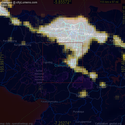
» NASA, Earths city lights 1995
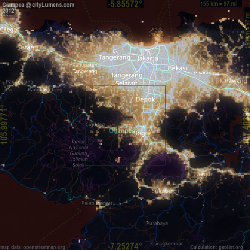
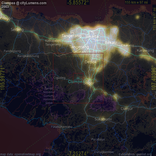
» NASA city lights 2003
» Earth at Night: Flat Maps 2012, 2016