Pelabuhanratu night lights from space
Night Light of Pelabuhanratu (West Java) from space (Indonesia) Src. Average luminocity for 10x10km area is 6.5325% and for 50x50km: 1.4154%.
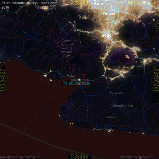
Analysis of Pelabuhanratu night lights 2016
Square area 10x10 km:
 0%
0%90-99
0%80-89
1.08%70-79
2.38%60-69
1.73%50-59
0.87%40-49
0%30-39
0.87%20-29
2.81%10-19
2.16%0-9
88.1%Square area 50x50 km:
0%90-99
0.03%80-89
0.13%70-79
0.19%60-69
0.33%50-59
0.22%40-49
0.51%30-39
0.36%20-29
0.45%10-19
0.8%0-9
96.98%Clear (daylight) street map image can be seen on geolist.org.
Map coordinates:
6° 17' 20.7" South, 105° 50' 53.8" East
6° 59' 15" South, 106° 33' 5" East
7° 41' 5.5" South, 107° 15' 16.3" East
Some cities around Pelabuhanratu sort by population:
• Bogor
51 km =31.7 mi,  30°
30°
• Sukabumi
42.1 km =26.2 mi,  79°
79°
• Ciampea
50.9 km =31.6 mi,  18°
18°
• Parung
66.1 km =41.1 mi, 17°
• Cibinong
65.4 km =40.6 mi, 30°
• Citeureup
66.7 km =41.4 mi, 33°
• Caringin
43.2 km =26.8 mi,  43°
43°
• Cicurug
34.3 km =21.3 mi,  48°
48°
1631733 (p: 43,001)
Sources (retrieved 2019-11-25):
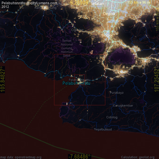
» Earth at Night: Flat Maps 2012, 2016