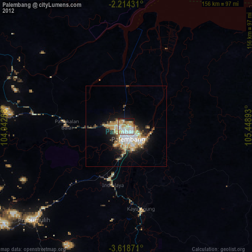
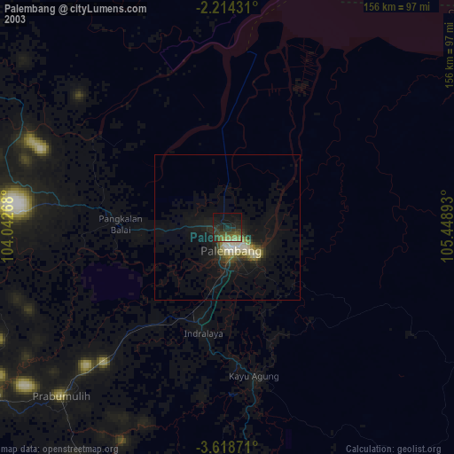
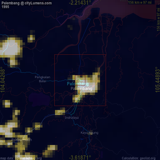
Palembang night lights from space
Night Light of Palembang (South Sumatra) from space (Indonesia) Src. Average luminocity for 10x10km area is 67.9307% and for 50x50km: 11.9348%.
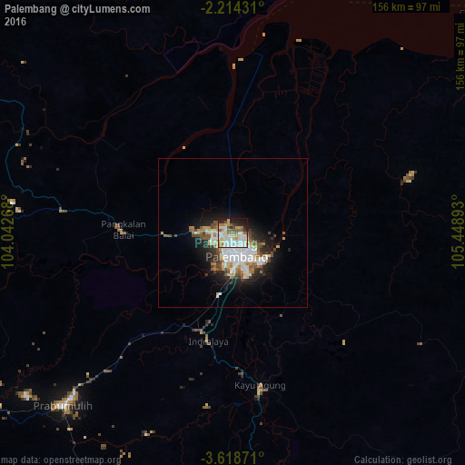
Analysis of Palembang night lights 2016
Square area 10x10 km:
 15.8%
15.8%90-99
22.51%80-89
9.31%70-79
6.49%60-69
9.09%50-59
9.31%40-49
3.25%30-39
3.68%20-29
9.74%10-19
10.17%0-9
0.65%Square area 50x50 km:
2.71%90-99
2.77%80-89
1%70-79
1.12%60-69
1.5%50-59
1.65%40-49
1.36%30-39
1.23%20-29
2.63%10-19
5.87%0-9
78.18%Clear (daylight) street map image can be seen on geolist.org.
Map coordinates:
2° 12' 51.5" South, 104° 2' 33.6" East
2° 55' 0.2" South, 104° 44' 44.9" East
3° 37' 7.4" South, 105° 26' 56.1" East
Some cities around Palembang sort by population:
• Jambi City
192.8 km =119.8 mi,  319°
319°
• Baturaja
149.3 km =92.8 mi,  205°
205°
• Pangkalpinang
175.4 km =109 mi,  60°
60°
• Prabumulih
81.2 km =50.5 mi,  224°
224°
• Sungailiat
193.2 km =120 mi,  52°
52°
• Lahat
164.8 km =102.4 mi,  234°
234°
• Tanjungagung
154.2 km =95.8 mi, 222°
• Muntok
105.2 km =65.4 mi,  26°
26°
1633070 (p: 1,441,500)
Sources (retrieved 2019-11-25):
» NASA, Earths city lights 1995
» NASA city lights 2003
» Earth at Night: Flat Maps 2012, 2016