Jambi City night lights from space
Night Light of Jambi City (Jambi) from space (Indonesia) Src. Average luminocity for 10x10km area is 66.0887% and for 50x50km: 5.9617%.
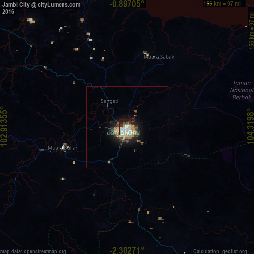
Analysis of Jambi City night lights 2016
Square area 10x10 km:
 14.07%
90-99
21%80-89
9.74%70-79
13.2%60-69
3.9%50-59
5.84%40-49
2.16%30-39
7.14%20-29
11.04%10-19
11.9%0-9
0%Square area 50x50 km:
0.61%90-99
1.12%80-89
0.71%70-79
0.86%60-69
0.74%50-59
0.64%40-49
0.74%30-39
1.58%20-29
1.46%10-19
4.17%0-9
87.37%Clear (daylight) street map image can be seen on geolist.org.
Map coordinates:
0° 53' 49.4" South, 102° 54' 48.8" East
1° 36' 0" South, 103° 37' 0" East
2° 18' 9.8" South, 104° 19' 11.3" East
Some cities around Jambi City sort by population:
• Palembang
192.8 km =119.8 mi,  139°
139°
• Lubuklinggau
206.2 km =128.1 mi,  204°
204°
• Prabumulih
215.1 km =133.7 mi,  161°
161°
• Mendaha
65 km =40.4 mi,  357°
357°
• Simpang
65.1 km =40.5 mi,  55°
55°
• Kuala Tungkal
88.8 km =55.2 mi,  348°
348°
• Muntok
179.5 km =111.5 mi,  106°
106°
• Bejubang Dua
39.6 km =24.6 mi,  237°
237°
1642858 (p: 420,323)
Sources (retrieved 2019-11-25):
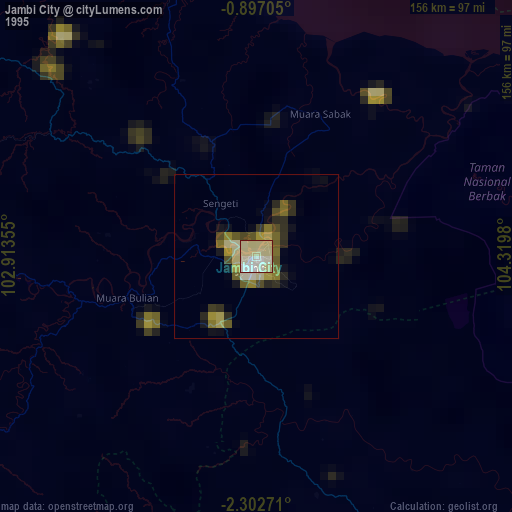
» NASA, Earths city lights 1995
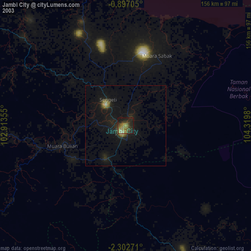
» NASA city lights 2003
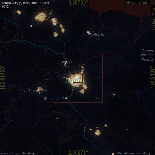
» Earth at Night: Flat Maps 2012, 2016