Kebomas night lights from space
Night Light of Kebomas (East Java) from space (Indonesia) Src. Average luminocity for 10x10km area is 88.2035% and for 50x50km: 50.5669%.
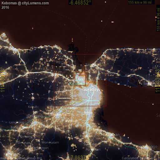
Analysis of Kebomas night lights 2016
Square area 10x10 km:
 27.49%
90-99
35.71%80-89
12.34%70-79
8.44%60-69
9.74%50-59
2.81%40-49
3.46%30-39
0%20-29
0%10-19
0%0-9
0%Square area 50x50 km:
12.22%90-99
11.26%80-89
5.79%70-79
6.41%60-69
4.79%50-59
5.08%40-49
8.41%30-39
8.5%20-29
11.34%10-19
15.65%0-9
10.55%Clear (daylight) street map image can be seen on geolist.org.
Map coordinates:
6° 28' 6.7" South, 111° 55' 48.6" East
7° 10' 0" South, 112° 37' 59.9" East
7° 51' 49.5" South, 113° 20' 11.1" East
Some cities around Kebomas sort by population:
• Surabaya
15.9 km =9.9 mi,  125°
125°
• Gedangan
27 km =16.8 mi,  157°
157°
• Gresik
2.9 km =1.8 mi,  60°
60°
• Bangkalan
17.5 km =10.9 mi,  39°
39°
• Lamongan
24.5 km =15.2 mi,  283°
283°
• Krian
27.7 km =17.2 mi,  192°
192°
• Driyorejo
22.2 km =13.8 mi,  183°
183°
• Kamal
9.5 km =5.9 mi,  90°
90°
1640765 (p: 75,982)
Sources (retrieved 2019-11-25):
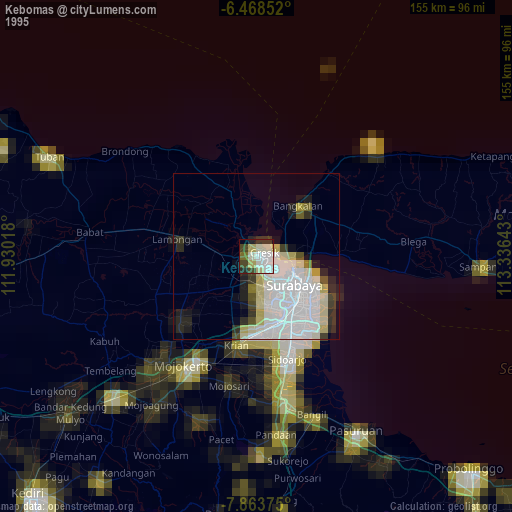
» NASA, Earths city lights 1995
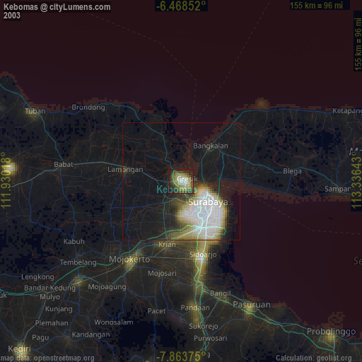
» NASA city lights 2003
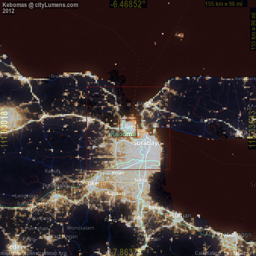
» Earth at Night: Flat Maps 2012, 2016