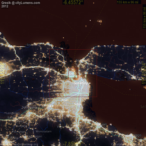
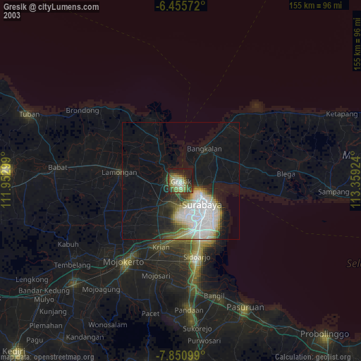
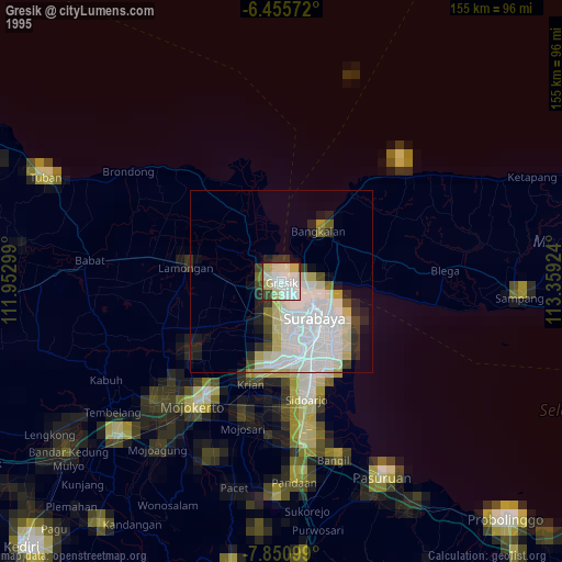
Gresik night lights from space
Night Light of Gresik (East Java) from space (Indonesia) Src. Average luminocity for 10x10km area is 81.4481% and for 50x50km: 48.2318%.
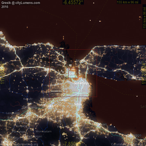
Analysis of Gresik night lights 2016
Square area 10x10 km:
 22.94%
90-99
34.42%80-89
7.58%70-79
7.36%60-69
6.06%50-59
6.06%40-49
8.44%30-39
6.93%20-29
0.22%10-19
0%0-9
0%Square area 50x50 km:
11.65%90-99
10.49%80-89
5.44%70-79
5.94%60-69
4.53%50-59
4.85%40-49
8.42%30-39
8.26%20-29
10.9%10-19
15.88%0-9
13.62%Clear (daylight) street map image can be seen on geolist.org.
Map coordinates:
6° 27' 20.6" South, 111° 57' 10.8" East
7° 9' 14" South, 112° 39' 22" East
7° 51' 3.6" South, 113° 21' 33.3" East
Some cities around Gresik sort by population:
• Surabaya
14.9 km =9.3 mi,  135°
135°
• Gedangan
27.5 km =17.1 mi,  163°
163°
• Kebomas
2.9 km =1.8 mi,  240°
240°
• Bangkalan
14.9 km =9.3 mi,  35°
35°
• Lamongan
26.7 km =16.6 mi,  278°
278°
• Krian
29.8 km =18.5 mi,  196°
196°
• Driyorejo
23.9 km =14.9 mi,  189°
189°
• Kamal
7.1 km =4.4 mi,  102°
102°
1643776 (p: 73,629)
Sources (retrieved 2019-11-25):
» NASA, Earths city lights 1995
» NASA city lights 2003
» Earth at Night: Flat Maps 2012, 2016